|
search place name
|
||
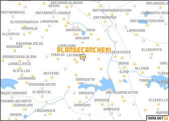
Plan de Canchemi (México, Mexico)Plan de Canchemi is a town in the México region of Mexico. An overview map of the region around Plan de Canchemi is displayed below.
regional and 3d topo map of Plan de Canchemi, Mexico ::
Plan de Canchemi airports ::
The nearest airport is TLC - Toluca Licenciado Adolfo Lopez Mateos Intl, located 32.8 km south east of Plan de Canchemi.
Other airports nearby include MEX - Mexico City Licenciado Benito Juarez Intl (79.8 km east), CVJ - Cuernavaca General Mariano Matamoros (94.6 km south east), PCA - Pachuca Ingeniero Juan Guillermo Villasana (127.1 km north east), QRO - Queretaro Intercontinental (129.5 km north), Nearby towns ::
Ocoyotepec Centro (1.6km west) //
La Trampa (2.1km west) //
San Francisco (2.9km east) //
La Unión de Ocoyotepec (3.7km south west) //
San Juan (4.1km north) //
San Agustín Citlali (3.9km south east) //
La Soledad (4.5km north west) //
Santa Catarina Tabernillas (4.5km south west) //
San Agustín (5.1km south) //
Loma del Salitre (5.1km south) //
El Rincón (5.5km north east) //
Cieneguillas de Mañones (5.9km south east) //
Yebucivi (5.7km west) //
Cachí (6.0km north) //
San Juan de las Manzanas (6.1km north) //
San Miguel (6.3km north) //
San Antonio Atotonilco (6.5km south east) //
San Lorenzo Toxico (6.4km east) //
Benito Juárez (6.8km south west) //
Salitrillo (7.4km south) //
Concepción (7.6km north) //
Dolores Enyegé (7.8km north) //
San Jerónimo Ixtapantongo (7.7km north east) //
San Diego (8.1km south) //
San Ildefonso (8.0km north east) //
Mextepec (7.8km south west) //
Yebucivi (7.9km west) //
La Manera (7.9km east) //
El Salitre de Mañones (8.2km south east) //
[all distances 'as the bird flies' and approximate] 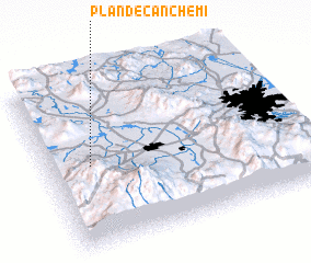 Places with similar names to Plan de Canchemi, Mexico :: Disclaimer :: Information on this page comes without warranty of any kind |
||
|
Where is Plan de Canchemi? Elevation and coordinates ::
Latitude (lat): 19°29'49"N Longitude (lon): 99°49'45"W
Elevation (approx.): 2661m (map arrows pan, magnifying glasses zoom) |
||
|
Visiting Plan de Canchemi? Hotel/Accommodation ::
Book a hotel in Plan de Canchemi Travel Guide ::
Buy a travel guide for Mexico rental cars ::
car rental offers GPS waypoint ::
download a GPX waypoint (PoI) of Plan de Canchemi for your GPS receiver
|
||