|
search place name
|
||
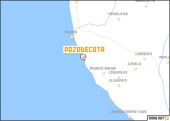
Pozo de Cota (Baja California Sur, Mexico)Pozo de Cota is a town in the Baja California Sur region of Mexico. An overview map of the region around Pozo de Cota is displayed below.
regional and 3d topo map of Pozo de Cota, Mexico ::
Pozo de Cota airports ::
The nearest airport is SJD - San Jose Del Cabo Los Cabos Intl, located 40.8 km north east of Pozo de Cota.
Other airports nearby include LAP - La Paz General Manuel Marquez De Leon Intl (122.2 km north), Nearby towns ::
Agua Escondida (4.7km south east) //
Migriño (5.8km north west) //
Los Verdes (7.8km south east) //
El Suspiro (8.8km south east) //
[all distances 'as the bird flies' and approximate] 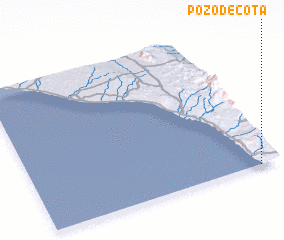 Places with similar names to Pozo de Cota, Mexico ::
Disclaimer :: Information on this page comes without warranty of any kind |
||
|
Where is Pozo de Cota? Elevation and coordinates ::
Latitude (lat): 23°0'0"N Longitude (lon): 110°5'0"W
Elevation (approx.): 19m (map arrows pan, magnifying glasses zoom) |
||
|
Visiting Pozo de Cota? Hotel/Accommodation ::
Book a hotel in Pozo de Cota Travel Guide ::
Buy a travel guide for Mexico rental cars ::
car rental offers GPS waypoint ::
download a GPX waypoint (PoI) of Pozo de Cota for your GPS receiver
|
||