|
search place name
|
||
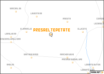
Presa El Tepetate (San Luis Potosí, Mexico)Presa El Tepetate is a town in the San Luis Potosí region of Mexico. An overview map of the region around Presa El Tepetate is displayed below.
regional and 3d topo map of Presa El Tepetate, Mexico ::
Presa El Tepetate airports ::
The nearest airport is SLP - San Luis Potosi Ponciano Arriaga Intl, located 105.1 km south west of Presa El Tepetate.
Other airports nearby include CVM - Ciudad Victoria General Pedro Jose Mendez Intl (154.5 km north east), TSL - Tamuin (175.7 km south east), BJX - Del Bajio Guanajuato Intl (251.4 km south west), Nearby towns ::
Presita (7.6km north east) //
Rancho Nuevo (9.0km south east) //
La Ventana (9.0km north west) //
Santo Domingo (10.1km south west) //
[all distances 'as the bird flies' and approximate] 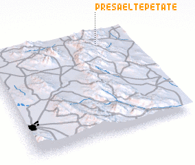 Places with similar names to Presa El Tepetate, Mexico :: Disclaimer :: Information on this page comes without warranty of any kind |
||
|
Where is Presa El Tepetate? Elevation and coordinates ::
Latitude (lat): 22°56'0"N Longitude (lon): 100°13'0"W
Elevation (approx.): 1313m (map arrows pan, magnifying glasses zoom) |
||
|
Visiting Presa El Tepetate? Hotel/Accommodation ::
Book a hotel in Presa El Tepetate Travel Guide ::
Buy a travel guide for Mexico rental cars ::
car rental offers GPS waypoint ::
download a GPX waypoint (PoI) of Presa El Tepetate for your GPS receiver
|
||