|
search place name
|
||
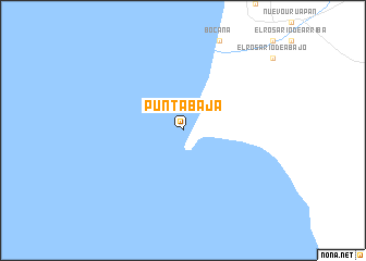
Punta Baja (Baja California, Mexico)Punta Baja is a town in the Baja California region of Mexico. An overview map of the region around Punta Baja is displayed below.
regional and 3d topo map of Punta Baja, Mexico ::
Punta Baja airports ::
The nearest airport is ESE - Ensenada, located 216.2 km north of Punta Baja.
Nearby towns ::
[all distances 'as the bird flies' and approximate]  Places with similar names to Punta Baja, Mexico ::
// Peón de Abajo (ES)
// Pin de Abajo (ES)
// Pindi Bajūāh (PK)
// Puente Abajo (HN)
// Piñita Abajo (DO)
Disclaimer :: Information on this page comes without warranty of any kind |
||
|
Where is Punta Baja? Elevation and coordinates ::
Latitude (lat): 29°58'0"N Longitude (lon): 115°49'0"W
Elevation (approx.): -32768m (map arrows pan, magnifying glasses zoom) |
||
|
Visiting Punta Baja? Hotel/Accommodation ::
Book a hotel in Punta Baja Travel Guide ::
Buy a travel guide for Mexico rental cars ::
car rental offers GPS waypoint ::
download a GPX waypoint (PoI) of Punta Baja for your GPS receiver
|
||