|
search place name
|
||
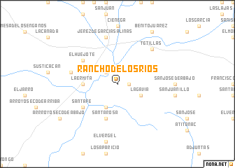
Rancho de los Ríos (Zacatecas, Mexico)Rancho de los Ríos is a town in the Zacatecas region of Mexico. An overview map of the region around Rancho de los Ríos is displayed below.
regional and 3d topo map of Rancho de los Ríos, Mexico ::
Rancho de los Ríos airports ::
The nearest airport is ZCL - Zacatecas General Leobardo C Ruiz Intl, located 46.2 km north east of Rancho de los Ríos.
Other airports nearby include AGU - Aguascalientes Jesus Teran Intl (119.0 km south east), TPQ - Tepic (231.2 km south west), DGO - Durango Intl (232.5 km north west), BJX - Del Bajio Guanajuato Intl (234.8 km south east), Nearby towns ::
Los Ríos (1.7km east) //
La Labor (2.5km north west) //
La Gavia (3.9km south east) //
El Tambor (4.1km south west) //
Ermita de Guadalupe (5.1km west) //
La Ermita (5.1km west) //
Santa Rosa (5.8km south) //
Santa Fe (6.3km south west) //
Santa Fé (6.3km south west) //
El Huejote (6.3km north west) //
El Refugio (7.1km west) //
Jerez de García Salinas (7.6km north) //
Tetillas (7.6km north east) //
Benito Juárez (9.8km north east) //
[all distances 'as the bird flies' and approximate] 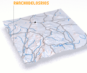 Places with similar names to Rancho de los Ríos, Mexico :: Disclaimer :: Information on this page comes without warranty of any kind |
||
|
Where is Rancho de los Ríos? Elevation and coordinates ::
Latitude (lat): 22°35'0"N Longitude (lon): 102°59'0"W
Elevation (approx.): 2011m (map arrows pan, magnifying glasses zoom) |
||
|
Visiting Rancho de los Ríos? Hotel/Accommodation ::
Book a hotel in Rancho de los Ríos Travel Guide ::
Buy a travel guide for Mexico rental cars ::
car rental offers GPS waypoint ::
download a GPX waypoint (PoI) of Rancho de los Ríos for your GPS receiver
|
||