|
search place name
|
||
Rancho Seco (Aguascalientes, Mexico)Rancho Seco is a town in the Aguascalientes region of Mexico. An overview map of the region around Rancho Seco is displayed below.
regional and 3d topo map of Rancho Seco, Mexico ::

Rancho Seco airports ::
The nearest airport is AGU - Aguascalientes Jesus Teran Intl, located 31.1 km south of Rancho Seco.
Other airports nearby include ZCL - Zacatecas General Leobardo C Ruiz Intl (109.8 km north west), BJX - Del Bajio Guanajuato Intl (136.9 km south east), SLP - San Luis Potosi Ponciano Arriaga Intl (141.6 km east), GDL - Guadalajara Don Miguel Hidalgo Y Costilla Intl (194.5 km south west), Nearby towns ::
El Puertecito (2.1km south east) //
Santa Fe (2.6km north west) //
Viñedos (2.6km south west) //
Puertecito de la Virgen (2.9km south east) //
Loreto (2.9km north east) //
Jesús Gómez Portugal (3.1km north west) //
Margaritas (3.4km north west) //
La Soledad (4.2km south) //
El Cortijo (4.4km north west) //
El Cortijo (4.4km north west) //
Cañada Honda (4.4km north east) //
El Maguey (4.7km north west) //
El Chamizal (5.0km north west) //
La Providencia (5.6km north) //
Enriqueta (5.6km north) //
El Maguey (5.4km north west) //
Chicalote (5.6km north) //
La Escondida (5.7km north) //
Valladolid (5.9km north west) //
La Concepción (6.3km north west) //
San Nicolás de Enmedio (6.1km south east) //
La Higuerilla (6.5km south) //
La Máquina (6.5km north) //
San Antonio de los Horcones (6.4km west) //
Loreto (6.5km west) //
El Tanque (6.6km east) //
Barranquilla (6.6km west) //
San Nicolás de Arriba (6.6km east) //
Maravillas (6.8km south west) //
[all distances 'as the bird flies' and approximate] 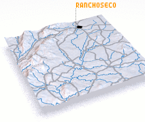 Places with similar names to Rancho Seco, Mexico ::
// Rancho Seco (MX)
// Rancho Seco (MX)
// Rancho Seco (MX)
// Rancho Seco (MX)
// Rancho Seco (MX)
// Rancho Seco (MX)
// Rancho Seco (MX)
// Rancho Seco (MX)
// Rancho Seco (MX)
// Rancho Seco (MX)
Disclaimer :: Information on this page comes without warranty of any kind |
||
|
Where is Rancho Seco? Elevation and coordinates ::
Latitude (lat): 21°59'0"N Longitude (lon): 102°16'20"W
Elevation (approx.): 1896m (map arrows pan, magnifying glasses zoom) |
||
|
Visiting Rancho Seco? Hotel/Accommodation ::
Book a hotel in Rancho Seco Travel Guide ::
Buy a travel guide for Mexico rental cars ::
car rental offers GPS waypoint ::
download a GPX waypoint (PoI) of Rancho Seco for your GPS receiver
|
||