|
search place name
|
||
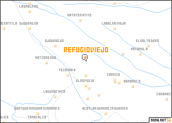
Refugio Viejo (Oaxaca, Mexico)Refugio Viejo is a town in the Oaxaca region of Mexico. An overview map of the region around Refugio Viejo is displayed below.
regional and 3d topo map of Refugio Viejo, Mexico ::
Refugio Viejo airports ::
The nearest airport is VER - Vera Cruz General Heriberto Jara Intl, located 75.0 km north east of Refugio Viejo.
Other airports nearby include TCN - Tehuacan (82.1 km west), OAX - Oaxaca Xoxocotlan Intl (181.2 km south), TXA - Tlaxcala (188.4 km north west), PBC - Puebla Hermanos Serdan Intl (189.8 km west), Nearby towns ::
Almolonga (3.1km south) //
Tezonapa (4.8km south west) //
El Refugio (5.3km south) //
Cosolapa (5.8km south) //
Carrizo (7.1km south east) //
Ojo de Agua (7.3km north west) //
Monte Obscuro (7.4km south east) //
San Miguel Carrizal (7.8km south) //
Rancho Tabla (8.1km south) //
Cimarrón (7.8km east) //
Aserradero (8.2km south east) //
Motzorongo (8.2km west) //
La Balsa Vieja (9.3km north east) //
Laguna Chica (10.0km south west) //
[all distances 'as the bird flies' and approximate] 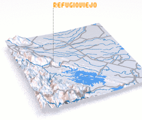 Places with similar names to Refugio Viejo, Mexico :: Disclaimer :: Information on this page comes without warranty of any kind |
||
|
Where is Refugio Viejo? Elevation and coordinates ::
Latitude (lat): 18°38'8"N Longitude (lon): 96°39'20"W
Elevation (approx.): 225m (map arrows pan, magnifying glasses zoom) |
||
|
Visiting Refugio Viejo? Hotel/Accommodation ::
Book a hotel in Refugio Viejo Travel Guide ::
Buy a travel guide for Mexico rental cars ::
car rental offers GPS waypoint ::
download a GPX waypoint (PoI) of Refugio Viejo for your GPS receiver
|
||