|
search place name
|
||
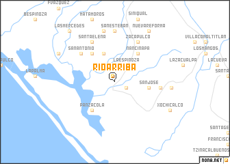
Río Arriba (Chiapas, Mexico)Río Arriba is a town in the Chiapas region of Mexico. An overview map of the region around Río Arriba is displayed below.
regional and 3d topo map of Río Arriba, Mexico ::
Río Arriba airports ::
The nearest airport is TAP - Tapachula Intl, located 54.9 km south east of Río Arriba.
Other airports nearby include TGZ - Tuxtla Gutierrez Angel Albino Corzo (158.8 km north), Nearby towns ::
Salvación (2.0km south east) //
La Espinoza (3.3km north east) //
Los Cerritos (5.0km north) //
San José (5.4km east) //
Panzacola (5.9km south west) //
La Esperanza (5.9km north west) //
Nancinapa (5.9km north east) //
San Antonio (7.1km north west) //
Hidalgo (7.2km east) //
Santa Elena (7.4km north west) //
Zacapulco (7.4km north east) //
San Esteban (8.3km north) //
Las Cruces (8.5km north) //
Nueva Reforma (9.9km north east) //
El Chojón (9.9km north east) //
Las Mercedes (11.0km north west) //
[all distances 'as the bird flies' and approximate] 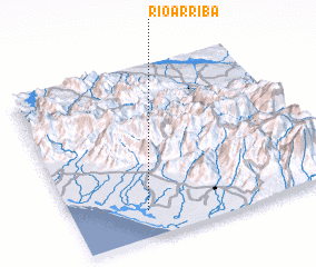 Places with similar names to Río Arriba, Mexico ::
// Río Arriba (PA)
// Río Arriba (PA)
// Rarēba (ET)
// Río Arriba (CO)
// Río Arriba (CO)
// Río Arriba (CO)
// Río Arriba (CO)
// Rairobo (TP)
// Río Arriba (GT)
// Río Arriba (GT)
Disclaimer :: Information on this page comes without warranty of any kind |
||
|
Where is Río Arriba? Elevation and coordinates ::
Latitude (lat): 15°9'30"N Longitude (lon): 92°43'0"W
Elevation (approx.): 5m (map arrows pan, magnifying glasses zoom) |
||
|
Visiting Río Arriba? Hotel/Accommodation ::
Book a hotel in Río Arriba Travel Guide ::
Buy a travel guide for Mexico rental cars ::
car rental offers GPS waypoint ::
download a GPX waypoint (PoI) of Río Arriba for your GPS receiver
|
||