|
search place name
|
||
San Agustín (Guanajuato, Mexico)San Agustín is a town in the Guanajuato region of Mexico. An overview map of the region around San Agustín is displayed below.
regional and 3d topo map of San Agustín, Mexico ::

San Agustín airports ::
The nearest airport is BJX - Del Bajio Guanajuato Intl, located 23.8 km north of San Agustín.
Other airports nearby include MLM - Morelia General Francisco J Mujica Intl (111.8 km south), ZMM - Zamora (120.1 km south west), QRO - Queretaro Intercontinental (131.3 km east), AGU - Aguascalientes Jesus Teran Intl (137.3 km north west), Nearby towns ::
Corrales (1.9km south) //
Santa Bárbara (3.2km north east) //
Serrano (3.9km south east) //
Caliche (4.1km south east) //
Trejo (4.1km north east) //
Noria de Camarena (4.4km south) //
San Antonio Texas (4.4km north east) //
El Venado (4.8km south west) //
Guadalupe de Paso Blanco (5.1km south east) //
Maritas (5.2km west) //
El Conejo (5.8km south) //
Las Trojes (6.3km north) //
Las Libres (6.3km north west) //
San José del Progreso (6.6km north east) //
San Antonio del Río (6.6km north east) //
Borregos (6.4km north west) //
Villalobos (6.4km north east) //
Tejamanil (6.6km west) //
Mezquite Gordo (7.3km north west) //
Vieyra (7.2km east) //
La Caja (7.9km south) //
San Antonio El Rico (7.7km north east) //
Unión de San Diego (8.2km north) //
Dolores de Gallegos (8.2km north east) //
Maravillas (8.5km north west) //
La Colonia Juárez (9.7km north west) //
Arandas (10.1km south east) //
San Ramón de Gallegos (10.2km north east) //
Los Sabinos (10.3km south east) //
[all distances 'as the bird flies' and approximate] 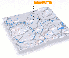 Places with similar names to San Agustín, Mexico ::
// San Agustin (US)
// San Augustine (US)
// San Agustín (PA)
// San Agustín (PA)
// San Agustín (CU)
// San Agustín (CU)
// San Agustín (CU)
// San Agustín (CU)
// San Agustín (CU)
// San Agustín (CU)
Disclaimer :: Information on this page comes without warranty of any kind |
||
|
Where is San Agustín? Elevation and coordinates ::
Latitude (lat): 20°47'0"N Longitude (lon): 101°26'0"W
Elevation (approx.): 1743m (map arrows pan, magnifying glasses zoom) |
||
|
Visiting San Agustín? Hotel/Accommodation ::
Book a hotel in San Agustín Travel Guide ::
Buy a travel guide for Mexico rental cars ::
car rental offers GPS waypoint ::
download a GPX waypoint (PoI) of San Agustín for your GPS receiver
|
||