|
search place name
|
||
San Agustín (Guanajuato, Mexico)San Agustín is a town in the Guanajuato region of Mexico. An overview map of the region around San Agustín is displayed below.
regional and 3d topo map of San Agustín, Mexico ::

San Agustín airports ::
The nearest airport is QRO - Queretaro Intercontinental, located 59.0 km south of San Agustín.
Other airports nearby include BJX - Del Bajio Guanajuato Intl (117.5 km west), SLP - San Luis Potosi Ponciano Arriaga Intl (138.4 km north west), MLM - Morelia General Francisco J Mujica Intl (157.3 km south west), TSL - Tamuin (190.0 km north east), Nearby towns ::
San Rafael (1.3km north east) //
Begoña (2.6km west) //
El Baño (3.3km north west) //
Morisguilla (3.8km south east) //
La Soledad (4.7km south) //
Doctor Mora (5.2km east) //
Pueblo Nuevo (5.5km south west) //
La Barranca (5.9km north west) //
Loma de Buenavista (6.4km north) //
La Escondida (6.5km south) //
Miranda (6.3km south east) //
Cabú (6.2km south west) //
Nona de Guadalupe (6.8km north) //
Derramadero (6.5km east) //
La Canela (6.6km south west) //
San José (6.6km north west) //
Los Vega de Abajo (7.5km south west) //
Arroyo de la Plata (7.8km north east) //
Los Amoles (8.0km north west) //
Tierra Prieta (8.5km north) //
Huisachal (8.2km west) //
El Ramillete (8.2km west) //
Viborillas (8.7km south west) //
El Magueyal (9.0km south east) //
Cruz de la Maza (8.9km south west) //
El Ciprés (10.0km south west) //
Las Adjuntas (10.2km south west) //
Puerto del Gato (10.3km north west) //
Galomo (11.3km south west) //
[all distances 'as the bird flies' and approximate] 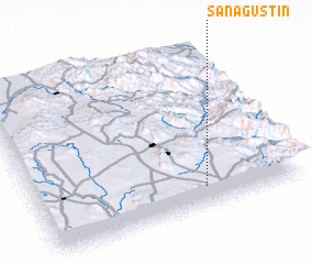 Places with similar names to San Agustín, Mexico ::
// San Agustin (US)
// San Augustine (US)
// San Agustín (PA)
// San Agustín (PA)
// San Agustín (CU)
// San Agustín (CU)
// San Agustín (CU)
// San Agustín (CU)
// San Agustín (CU)
// San Agustín (CU)
Disclaimer :: Information on this page comes without warranty of any kind |
||
|
Where is San Agustín? Elevation and coordinates ::
Latitude (lat): 21°7'28"N Longitude (lon): 100°21'33"W
Elevation (approx.): 2076m (map arrows pan, magnifying glasses zoom) |
||
|
Visiting San Agustín? Hotel/Accommodation ::
Book a hotel in San Agustín Travel Guide ::
Buy a travel guide for Mexico rental cars ::
car rental offers GPS waypoint ::
download a GPX waypoint (PoI) of San Agustín for your GPS receiver
|
||