|
search place name
|
||
San Andrés (Guanajuato, Mexico)San Andrés is a town in the Guanajuato region of Mexico. An overview map of the region around San Andrés is displayed below.
regional and 3d topo map of San Andrés, Mexico ::

San Andrés airports ::
The nearest airport is QRO - Queretaro Intercontinental, located 75.5 km south east of San Andrés.
Other airports nearby include BJX - Del Bajio Guanajuato Intl (82.8 km west), SLP - San Luis Potosi Ponciano Arriaga Intl (129.6 km north), MLM - Morelia General Francisco J Mujica Intl (143.2 km south), AGU - Aguascalientes Jesus Teran Intl (181.1 km west), Nearby towns ::
Jamaica (1.5km north west) //
El Ocote (2.3km south) //
La Lona (2.5km west) //
La Boya (3.0km north east) //
La Grulla de Abajo (3.0km west) //
Chirriaga (3.1km north west) //
Pozo de Balderas (3.1km east) //
La Palmilla (4.1km south) //
Palo Mocho (4.0km north east) //
Los Méndez (4.2km north west) //
San Isidro del Monte (4.8km north) //
El Rosano (5.1km north) //
San Jerónimo (5.6km north east) //
Los Rodríguez (6.6km south) //
Cruz del Meco (6.9km north) //
Las Liebres (6.7km east) //
La Estacada (7.3km north) //
La Estancia (7.4km south) //
Corrales (7.1km south west) //
San Francisco (7.3km north west) //
Los Guías (7.5km south west) //
La Perla (7.3km east) //
Jesús María (7.6km south east) //
San Pablo (7.8km north) //
La Luz (7.6km north west) //
Fátima (7.9km north) //
Refugio (7.9km east) //
Las Trojes deBelén (8.3km south west) //
La Pilorina (8.7km south east) //
[all distances 'as the bird flies' and approximate] 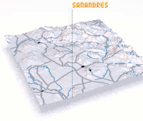 Places with similar names to San Andrés, Mexico ::
// San Andres (BZ)
// San Andreas (US)
// San Andrés (PA)
// San Andrés (PA)
// San Andrés (CU)
// San Andrés (CU)
// San Andrés (CU)
// San Andrés (CU)
// San Andrés (CU)
// San Andrés (CU)
Disclaimer :: Information on this page comes without warranty of any kind |
||
|
Where is San Andrés? Elevation and coordinates ::
Latitude (lat): 21°6'19"N Longitude (lon): 100°41'35"W
Elevation (approx.): 2006m (map arrows pan, magnifying glasses zoom) |
||
|
Visiting San Andrés? Hotel/Accommodation ::
Book a hotel in San Andrés Travel Guide ::
Buy a travel guide for Mexico rental cars ::
car rental offers GPS waypoint ::
download a GPX waypoint (PoI) of San Andrés for your GPS receiver
|
||