|
search place name
|
||
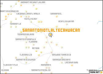
San Antonio Tlaltecahuacan (México, Mexico)San Antonio Tlaltecahuacan is a town in the México region of Mexico. An overview map of the region around San Antonio Tlaltecahuacan is displayed below.
regional and 3d topo map of San Antonio Tlaltecahuacan, Mexico ::
San Antonio Tlaltecahuacan airports ::
The nearest airport is PBC - Puebla Hermanos Serdan Intl, located 41.6 km east of San Antonio Tlaltecahuacan.
Other airports nearby include MEX - Mexico City Licenciado Benito Juarez Intl (43.8 km north west), CVJ - Cuernavaca General Mariano Matamoros (63.7 km south west), TXA - Tlaxcala (74.7 km north east), TLC - Toluca Licenciado Adolfo Lopez Mateos Intl (86.1 km west), Nearby towns ::
Zohuachpa (1.8km west) //
Santo Tomás Atzingo (1.8km west) //
Santa Isabel Chalma (1.9km south) //
San Francisco Zentlapa (2.5km south west) //
Cuatenampa (2.9km north west) //
Santiago Cuautenco (3.3km south east) //
La Mesa (4.0km north west) //
San Juan Atzacualoya (4.1km north east) //
San Cristóbal Poxtla (4.5km south west) //
El Salto (5.1km south east) //
Amecameca de Juárez (5.6km south) //
Paso de Huichila (5.6km west) //
Tlalmanalco de Velázquez (6.6km north west) //
San Lorenzo Tlalmimiolpan (6.6km north west) //
Ayapango (6.6km south west) //
Tlamapa (6.7km south west) //
Acatlixhuayan (7.0km north east) //
San Mateo Tezoquipan (7.1km north west) //
Retama (7.3km south west) //
San Rafael (7.6km north) //
Pahuacan (7.8km south west) //
San José Tomacoco (8.2km south east) //
San Juan Coxtocan (8.7km south west) //
Toxtlitepet (8.9km north west) //
San Andrés Metla (8.9km north west) //
La Candelaria Tlapala (10.8km north west) //
[all distances 'as the bird flies' and approximate]  Places with similar names to San Antonio Tlaltecahuacan, Mexico :: Disclaimer :: Information on this page comes without warranty of any kind |
||
|
Where is San Antonio Tlaltecahuacan? Elevation and coordinates ::
Latitude (lat): 19°10'0"N Longitude (lon): 98°46'0"W
Elevation (approx.): 2593m (map arrows pan, magnifying glasses zoom) |
||
|
Visiting San Antonio Tlaltecahuacan? Hotel/Accommodation ::
Book a hotel in San Antonio Tlaltecahuacan Travel Guide ::
Buy a travel guide for Mexico rental cars ::
car rental offers GPS waypoint ::
download a GPX waypoint (PoI) of San Antonio Tlaltecahuacan for your GPS receiver
|
||