|
search place name
|
||
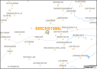
San Cristóbal (Guanajuato, Mexico)San Cristóbal is a town in the Guanajuato region of Mexico. An overview map of the region around San Cristóbal is displayed below.
regional and 3d topo map of San Cristóbal, Mexico ::
San Cristóbal airports ::
The nearest airport is BJX - Del Bajio Guanajuato Intl, located 45.6 km west of San Cristóbal.
Other airports nearby include QRO - Queretaro Intercontinental (95.9 km east), MLM - Morelia General Francisco J Mujica Intl (118.1 km south), SLP - San Luis Potosi Ponciano Arriaga Intl (148.6 km north), AGU - Aguascalientes Jesus Teran Intl (157.9 km north west), Nearby towns ::
La Cantera (1.3km north west) //
El Terrero (2.6km east) //
Robledo (3.9km south west) //
Las Rusias (4.5km north) //
Santa Catarina (4.5km east) //
Manantiales (5.5km east) //
La Cruz de Pastor (5.9km north) //
San José de los Allende (6.5km south) //
El Rincón de Estaño (6.7km west) //
Joconoxtle de Ramátalo (7.0km north east) //
Cañada de Garcia (6.9km south east) //
San José Xoconoxtle (7.2km east) //
San Damián (7.6km north east) //
El Chorro (7.9km south west) //
Don Pedro (11.7km north east) //
[all distances 'as the bird flies' and approximate]  Places with similar names to San Cristóbal, Mexico ::
// San Cristóbal (PA)
// San Cristóbal (PA)
// San Cristóbal (PA)
// San Cristóbal (PA)
// San Cristóbal (PA)
// San Cristóbal (CU)
// San Cristóbal (CU)
// San Cristóbal (CU)
// San Cristóbal (CU)
// San Cristóbal (CU)
Disclaimer :: Information on this page comes without warranty of any kind |
||
|
Where is San Cristóbal? Elevation and coordinates ::
Latitude (lat): 20°55'0"N Longitude (lon): 101°3'0"W
Elevation (approx.): 2090m (map arrows pan, magnifying glasses zoom) |
||
|
Visiting San Cristóbal? Hotel/Accommodation ::
Book a hotel in San Cristóbal Travel Guide ::
Buy a travel guide for Mexico rental cars ::
car rental offers GPS waypoint ::
download a GPX waypoint (PoI) of San Cristóbal for your GPS receiver
|
||