|
search place name
|
||
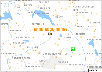
San Diego Linares (México, Mexico)San Diego Linares is a town in the México region of Mexico. An overview map of the region around San Diego Linares is displayed below.
regional and 3d topo map of San Diego Linares, Mexico ::
San Diego Linares airports ::
The nearest airport is TLC - Toluca Licenciado Adolfo Lopez Mateos Intl, located 9.2 km south east of San Diego Linares.
Other airports nearby include MEX - Mexico City Licenciado Benito Juarez Intl (60.0 km east), CVJ - Cuernavaca General Mariano Matamoros (72.4 km south east), PCA - Pachuca Ingeniero Juan Guillermo Villasana (118.4 km north east), PBC - Puebla Hermanos Serdan Intl (135.6 km east), Nearby towns ::
San Lucas (1.9km south west) //
Villa Seca (2.1km north east) //
Buenavista (2.8km west) //
San Diego de los Padres (3.0km east) //
San Andrés Cuexcontitlán (3.2km south east) //
San Pablo Autopan (3.6km south west) //
Sección Siete (3.8km north east) //
Tepexcatitlán (4.2km south east) //
San Antonio del Puente (4.8km north east) //
San Cristóbal Huichochitlán (5.1km south) //
Mojada (5.0km north west) //
San José Pathé (5.4km north) //
El Cerrillo (5.4km north west) //
Guadalupe Victoria (6.1km east) //
Santín (6.2km east) //
San Martín Toltepec (6.3km west) //
Dolores (6.6km north east) //
San Mateo Otzacatipan (6.9km south east) //
San José Buenavista (7.0km north east) //
San Lorenzo (7.2km north east) //
Yachihuacaltepec (7.5km south west) //
Calixtlahuaca (7.4km south west) //
Dolores (7.7km north) //
Tlachaloya (7.7km north) //
San Cayetano (7.4km west) //
San Lorenzo Tepaltitlán (8.0km south) //
San Diego Alcalá (8.2km north) //
San Martín Toltepec (7.9km south west) //
San Lorenzo Oyamel (8.2km north east) //
[all distances 'as the bird flies' and approximate] 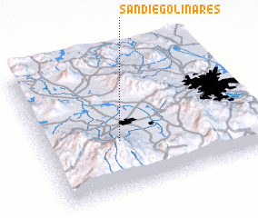 Places with similar names to San Diego Linares, Mexico :: Disclaimer :: Information on this page comes without warranty of any kind |
||
|
Where is San Diego Linares? Elevation and coordinates ::
Latitude (lat): 19°22'51"N Longitude (lon): 99°38'25"W
Elevation (approx.): 2608m (map arrows pan, magnifying glasses zoom) |
||
|
Visiting San Diego Linares? Hotel/Accommodation ::
Book a hotel in San Diego Linares Travel Guide ::
Buy a travel guide for Mexico rental cars ::
car rental offers GPS waypoint ::
download a GPX waypoint (PoI) of San Diego Linares for your GPS receiver
|
||