|
search place name
|
||
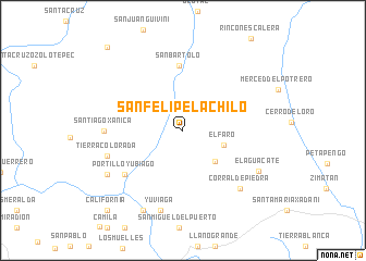
San Felipe Lachilo (Oaxaca, Mexico)San Felipe Lachilo is a town in the Oaxaca region of Mexico. An overview map of the region around San Felipe Lachilo is displayed below.
regional and 3d topo map of San Felipe Lachilo, Mexico ::
San Felipe Lachilo airports ::
The nearest airport is HUX - Bahias Dehuatulco Bahias De Huatulco Intl, located 27.8 km south of San Felipe Lachilo.
Other airports nearby include PXM - Puerto Escondido Intl (100.2 km west), OAX - Oaxaca Xoxocotlan Intl (125.3 km north west), Nearby towns ::
El Faro (4.4km east) //
La Constancia (4.5km south east) //
San Bartolo (6.7km north) //
Portillo Yubiago (7.3km south west) //
Santiago Xanica (7.8km west) //
Del Frijol (8.0km west) //
Tierra Colorada (8.0km west) //
Cajón (8.0km west) //
Corral de Piedra (8.2km south east) //
Yuviaga (8.5km south) //
El Aguacate (8.5km south east) //
Fruta del Cajón (8.7km south west) //
Piedras Negras (9.1km south west) //
California (11.1km south west) //
Alemania (11.1km south west) //
Santa Catarina Xanaquía (11.3km north west) //
[all distances 'as the bird flies' and approximate]  Places with similar names to San Felipe Lachilo, Mexico :: Disclaimer :: Information on this page comes without warranty of any kind |
||
|
Where is San Felipe Lachilo? Elevation and coordinates ::
Latitude (lat): 16°0'25"N Longitude (lon): 96°9'47"W
Elevation (approx.): 849m (map arrows pan, magnifying glasses zoom) |
||
|
Visiting San Felipe Lachilo? Hotel/Accommodation ::
Book a hotel in San Felipe Lachilo Travel Guide ::
Buy a travel guide for Mexico rental cars ::
car rental offers GPS waypoint ::
download a GPX waypoint (PoI) of San Felipe Lachilo for your GPS receiver
|
||