|
search place name
|
||
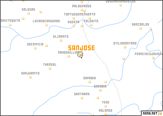
San José (Oaxaca, Mexico)San José is a town in the Oaxaca region of Mexico. An overview map of the region around San José is displayed below.
regional and 3d topo map of San José, Mexico ::
San José airports ::
The nearest airport is MTT - Minatitlan, located 119.1 km north east of San José.
Other airports nearby include OAX - Oaxaca Xoxocotlan Intl (177.3 km west), HUX - Bahias Dehuatulco Bahias De Huatulco Intl (197.2 km south west), Nearby towns ::
Palomares (1.9km north) //
Ramos Millián (2.9km west) //
Sarabia (5.8km south) //
San Francisco (5.8km south) //
El Zapote (6.1km north west) //
Boca Tortuguero (7.4km north) //
Catarino (7.6km north) //
Puerta (7.6km north) //
The Real (7.4km west) //
Boca del Monte (7.7km south east) //
Tolosita (7.9km north) //
Arroyo Limón (8.2km west) //
Sarabia (8.5km south east) //
Lázaro Cárdenas (10.8km north west) //
[all distances 'as the bird flies' and approximate] 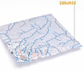 Places with similar names to San José, Mexico ::
Disclaimer :: Information on this page comes without warranty of any kind |
||
|
Where is San José? Elevation and coordinates ::
Latitude (lat): 17°8'0"N Longitude (lon): 95°4'0"W
Elevation (approx.): 111m (map arrows pan, magnifying glasses zoom) |
||
|
Visiting San José? Hotel/Accommodation ::
Book a hotel in San José Travel Guide ::
Buy a travel guide for Mexico rental cars ::
car rental offers GPS waypoint ::
download a GPX waypoint (PoI) of San José for your GPS receiver
|
||