|
search place name
|
||
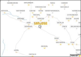
San José (Yucatán, Mexico)San José is a town in the Yucatán region of Mexico. An overview map of the region around San José is displayed below.
regional and 3d topo map of San José, Mexico ::
San José airports ::
The nearest airport is MID - Merida Licenciado Manuel Crescencio Rejon Int, located 52.1 km north of San José.
Other airports nearby include CPE - Campeche Ingeniero Alberto Acuna Ongay Intl (113.0 km south west), CTM - Chetumal Intl (258.8 km south east), Nearby towns ::
Tepacan (3.7km north) //
San Francisco (5.1km north east) //
San Miguel (5.2km west) //
Yaxcopil (5.8km north) //
Muna (5.5km west) //
Poposit (6.6km north west) //
Teso (6.6km north east) //
Yaxhá (7.4km north) //
San Andrés (7.6km north east) //
Choyob (8.2km north west) //
San Antonio Sodzil (9.1km north east) //
Bella Flor (9.1km north east) //
Yokat (8.9km south east) //
[all distances 'as the bird flies' and approximate] 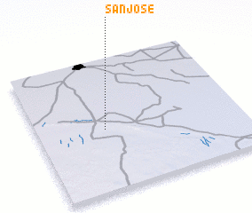 Places with similar names to San José, Mexico ::
Disclaimer :: Information on this page comes without warranty of any kind |
||
|
Where is San José? Elevation and coordinates ::
Latitude (lat): 20°28'0"N Longitude (lon): 89°40'0"W
Elevation (approx.): 23m (map arrows pan, magnifying glasses zoom) |
||
|
Visiting San José? Hotel/Accommodation ::
Book a hotel in San José Travel Guide ::
Buy a travel guide for Mexico rental cars ::
car rental offers GPS waypoint ::
download a GPX waypoint (PoI) of San José for your GPS receiver
|
||