|
search place name
|
||
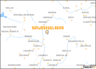
San José de la Era (Zacatecas, Mexico)San José de la Era is a town in the Zacatecas region of Mexico. An overview map of the region around San José de la Era is displayed below.
regional and 3d topo map of San José de la Era, Mexico ::
San José de la Era airports ::
The nearest airport is ZCL - Zacatecas General Leobardo C Ruiz Intl, located 25.8 km east of San José de la Era.
Other airports nearby include AGU - Aguascalientes Jesus Teran Intl (141.7 km south east), DGO - Durango Intl (215.5 km north west), TPQ - Tepic (252.8 km south west), BJX - Del Bajio Guanajuato Intl (254.5 km south east), Nearby towns ::
El Naranjal (1.9km north) //
San Cayetano (2.5km south west) //
Nuevo Día (4.1km north west) //
Los Nogales (4.1km south west) //
La Ordeña (5.6km north) //
San Antonio (6.3km south west) //
El Tesorero (6.3km south west) //
Los Félix (6.5km south west) //
Zamora (7.1km east) //
Órganos (7.6km north) //
Briseño (7.1km west) //
El Bajío de Claras (7.6km south west) //
Saucillo (10.1km south east) //
Los Juárez (10.1km south west) //
[all distances 'as the bird flies' and approximate] 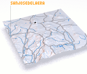 Places with similar names to San José de la Era, Mexico ::
// San José del Oro (MX)
// San José del Oro (MX)
// San José del Río (MX)
// San José del Río (MX)
// San José del Río (MX)
// San José del Río (MX)
// San José del Río (MX)
// San José de Lira (VE)
Disclaimer :: Information on this page comes without warranty of any kind |
||
|
Where is San José de la Era? Elevation and coordinates ::
Latitude (lat): 22°51'0"N Longitude (lon): 102°56'0"W
Elevation (approx.): 2232m (map arrows pan, magnifying glasses zoom) |
||
|
Visiting San José de la Era? Hotel/Accommodation ::
Book a hotel in San José de la Era Travel Guide ::
Buy a travel guide for Mexico rental cars ::
car rental offers GPS waypoint ::
download a GPX waypoint (PoI) of San José de la Era for your GPS receiver
|
||