|
search place name
|
||
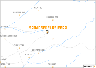
San José de la Sierra (Baja California, Mexico)San José de la Sierra is a town in the Baja California region of Mexico. An overview map of the region around San José de la Sierra is displayed below.
regional and 3d topo map of San José de la Sierra, Mexico ::
San José de la Sierra airports ::
The nearest airport is ESE - Ensenada, located 73.5 km north west of San José de la Sierra.
Other airports nearby include CXL - Calexico Intl (158.9 km north), TIJ - Tijuana General Abelardo L Rodriguez Intl (160.4 km north west), MXL - Mexicali General Rodolfo Sanchez Taboada Intl (165.3 km north east), NJK - El Centro Naf (171.8 km north), Nearby towns ::
Los Coches (2.4km south east) //
Agua Amarga (5.8km north) //
Los Panchos (8.1km south west) //
[all distances 'as the bird flies' and approximate] 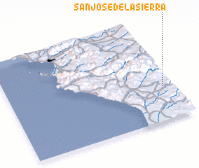 Places with similar names to San José de la Sierra, Mexico ::
// San José de la Zorra (MX)
// San José del Cerro (HN)
// San José de la Sierra (VE)
// San José del Cerro (VE)
// San José del Sur (NI)
Disclaimer :: Information on this page comes without warranty of any kind |
||
|
Where is San José de la Sierra? Elevation and coordinates ::
Latitude (lat): 31°19'0"N Longitude (lon): 116°4'0"W
Elevation (approx.): 304m (map arrows pan, magnifying glasses zoom) |
||
|
Visiting San José de la Sierra? Hotel/Accommodation ::
Book a hotel in San José de la Sierra Travel Guide ::
Buy a travel guide for Mexico rental cars ::
car rental offers GPS waypoint ::
download a GPX waypoint (PoI) of San José de la Sierra for your GPS receiver
|
||