|
search place name
|
||
San Luis del Río (Oaxaca, Mexico)San Luis del Río is a town in the Oaxaca region of Mexico. An overview map of the region around San Luis del Río is displayed below.
regional and 3d topo map of San Luis del Río, Mexico ::

San Luis del Río airports ::
The nearest airport is OAX - Oaxaca Xoxocotlan Intl, located 61.0 km north west of San Luis del Río.
Other airports nearby include HUX - Bahias Dehuatulco Bahias De Huatulco Intl (111.7 km south), PXM - Puerto Escondido Intl (138.2 km south west), MTT - Minatitlan (225.7 km north east), TCN - Tehuacan (229.6 km north west), Nearby towns ::
Santo Tomás de Arriba (3.3km west) //
Guegobia (4.0km north east) //
Piedra Chica (7.2km south east) //
Lachivelde (7.4km south) //
Las Margaritas (8.5km south) //
[all distances 'as the bird flies' and approximate] 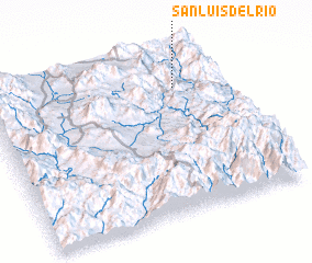 Places with similar names to San Luis del Río, Mexico :: Disclaimer :: Information on this page comes without warranty of any kind |
||
|
Where is San Luis del Río? Elevation and coordinates ::
Latitude (lat): 16°47'0"N Longitude (lon): 96°12'0"W
Elevation (approx.): 1468m (map arrows pan, magnifying glasses zoom) |
||
|
Visiting San Luis del Río? Hotel/Accommodation ::
Book a hotel in San Luis del Río Travel Guide ::
Buy a travel guide for Mexico rental cars ::
car rental offers GPS waypoint ::
download a GPX waypoint (PoI) of San Luis del Río for your GPS receiver
|
||