|
search place name
|
||
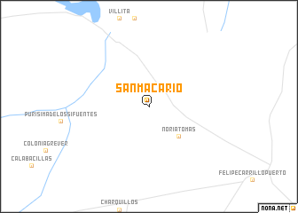
San Macario (Zacatecas, Mexico)San Macario is a town in the Zacatecas region of Mexico. An overview map of the region around San Macario is displayed below.
regional and 3d topo map of San Macario, Mexico ::
San Macario airports ::
The nearest airport is ZCL - Zacatecas General Leobardo C Ruiz Intl, located 122.1 km south of San Macario.
Other airports nearby include TRC - Torreon Intl (218.3 km north west), SLW - Saltillo Plan De Guadalupe Intl (223.9 km north east), SLP - San Luis Potosi Ponciano Arriaga Intl (227.4 km south east), NTR - Monterrey Del Norte Intl (295.4 km north east), Nearby towns ::
Noria Tomás (5.0km south east) //
[all distances 'as the bird flies' and approximate] 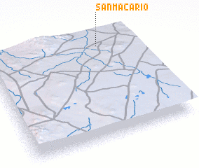 Places with similar names to San Macario, Mexico ::
// Sonāmugri (BD)
// San Macario (PH)
Disclaimer :: Information on this page comes without warranty of any kind |
||
|
Where is San Macario? Elevation and coordinates ::
Latitude (lat): 23°55'0"N Longitude (lon): 102°14'0"W
Elevation (approx.): 1878m (map arrows pan, magnifying glasses zoom) |
||
|
Visiting San Macario? Hotel/Accommodation ::
Book a hotel in San Macario Travel Guide ::
Buy a travel guide for Mexico rental cars ::
car rental offers GPS waypoint ::
download a GPX waypoint (PoI) of San Macario for your GPS receiver
|
||