|
search place name
|
||
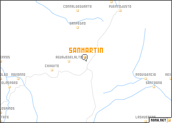
San Martín (Durango, Mexico)San Martín is a town in the Durango region of Mexico. An overview map of the region around San Martín is displayed below.
regional and 3d topo map of San Martín, Mexico ::
San Martín airports ::
The nearest airport is CUU - Chihuahua General R Fierro Villalobos Intl, located 218.5 km north of San Martín.
Other airports nearby include CUL - Culiacan Intl (259.9 km south west), Nearby towns ::
Aguaje del Alto (3.3km west) //
Chihuite (6.9km west) //
San Pedro (7.6km north) //
[all distances 'as the bird flies' and approximate] 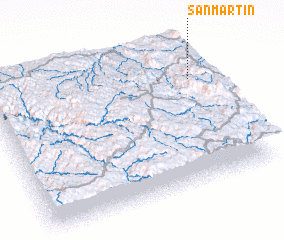 Places with similar names to San Martín, Mexico ::
// San Martin (US)
// San Martín (PA)
// San Martín (PA)
// San Martino (IT)
// San Martino (IT)
// San Martino (IT)
// San Martino (IT)
// San Martino (IT)
// San Martino (IT)
// San Martino (IT)
Disclaimer :: Information on this page comes without warranty of any kind |
||
|
Where is San Martín? Elevation and coordinates ::
Latitude (lat): 26°44'0"N Longitude (lon): 106°4'0"W
Elevation (approx.): 2225m (map arrows pan, magnifying glasses zoom) |
||
|
Visiting San Martín? Hotel/Accommodation ::
Book a hotel in San Martín Travel Guide ::
Buy a travel guide for Mexico rental cars ::
car rental offers GPS waypoint ::
download a GPX waypoint (PoI) of San Martín for your GPS receiver
|
||