|
search place name
|
||
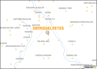
San Miguel Reyes (Oaxaca, Mexico)San Miguel Reyes is a town in the Oaxaca region of Mexico. An overview map of the region around San Miguel Reyes is displayed below.
regional and 3d topo map of San Miguel Reyes, Mexico ::
San Miguel Reyes airports ::
The nearest airport is OAX - Oaxaca Xoxocotlan Intl, located 125.3 km east of San Miguel Reyes.
Other airports nearby include PXM - Puerto Escondido Intl (144.0 km south east), TCN - Tehuacan (182.2 km north), ACA - Acapulco General Juan N Alvarez Intl (198.4 km west), HUX - Bahias Dehuatulco Bahias De Huatulco Intl (215.8 km south east), Nearby towns ::
El Limón (0.0km north) //
Palma Real (1.9km south) //
Palo del Obo (4.1km south west) //
Guadalupe Victoria (4.2km south east) //
Tortolita (4.9km north) //
Huertas (5.1km north west) //
Cuauhtémoc (5.5km north west) //
Sesteadero (6.6km north west) //
El Amate Colorado (7.0km north) //
Zafra (7.4km north) //
Mesones (7.1km west) //
La Muralla (7.6km north west) //
Carmen (8.2km north west) //
La Mesa (8.2km west) //
Hidalgo (8.2km west) //
Zimatlán (8.8km east) //
[all distances 'as the bird flies' and approximate] 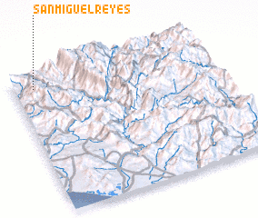 Places with similar names to San Miguel Reyes, Mexico :: Disclaimer :: Information on this page comes without warranty of any kind |
||
|
Where is San Miguel Reyes? Elevation and coordinates ::
Latitude (lat): 16°55'0"N Longitude (lon): 97°54'0"W
Elevation (approx.): 789m (map arrows pan, magnifying glasses zoom) |
||
|
Visiting San Miguel Reyes? Hotel/Accommodation ::
Book a hotel in San Miguel Reyes Travel Guide ::
Buy a travel guide for Mexico rental cars ::
car rental offers GPS waypoint ::
download a GPX waypoint (PoI) of San Miguel Reyes for your GPS receiver
|
||