|
search place name
|
||
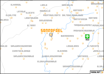
San Rafael (Aguascalientes, Mexico)San Rafael is a town in the Aguascalientes region of Mexico. An overview map of the region around San Rafael is displayed below.
regional and 3d topo map of San Rafael, Mexico ::
San Rafael airports ::
The nearest airport is AGU - Aguascalientes Jesus Teran Intl, located 11.9 km east of San Rafael.
Other airports nearby include BJX - Del Bajio Guanajuato Intl (126.3 km south east), ZCL - Zacatecas General Leobardo C Ruiz Intl (134.7 km north), GDL - Guadalajara Don Miguel Hidalgo Y Costilla Intl (159.5 km south west), SLP - San Luis Potosi Ponciano Arriaga Intl (166.7 km east), Nearby towns ::
La Cruz (0.5km south) //
La Hacienda (1.0km south) //
La Noria (1.4km north) //
Cieneguilla (2.2km north west) //
San Pedro Cieneguilla (2.4km north east) //
La Esperanza (3.3km south west) //
La Chiripa (3.6km south west) //
Cieneguilla (3.7km west) //
El Chilarillo (4.5km south) //
San Isidro (4.5km south west) //
Buenos Aires (5.2km east) //
San Jerónimo (5.5km north west) //
La Bodega (6.0km north west) //
La Soledad (6.2km east) //
Puerta del Norte (6.9km north) //
Alazanas (6.9km south east) //
El Gavilán de Arriba (7.9km south) //
Centro de Arriba (7.6km north west) //
El Taray (7.6km north west) //
Los Dolores (8.1km south east) //
Rodadillo (8.8km north) //
Las Tres Marías (9.0km north) //
El Salitre (8.7km north west) //
El Salto (8.9km north east) //
Las Atarjeas (9.1km north west) //
Salto de los Salados (9.8km north east) //
Agostaderito (10.1km north east) //
El Ocote (10.8km north west) //
San José de la Esperanzas (12.0km north east) //
[all distances 'as the bird flies' and approximate] 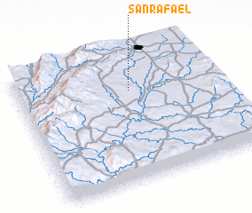 Places with similar names to San Rafael, Mexico ::
// San Rafael (US)
// San Rafael (US)
// Sonoraville (US)
// San Rafael (PA)
// San Rafael (PA)
// San Ruffillo (IT)
// San Rafael (CU)
// San Rafael (CU)
// San Rafael (CU)
// San Rafael (CU)
Disclaimer :: Information on this page comes without warranty of any kind |
||
|
Where is San Rafael? Elevation and coordinates ::
Latitude (lat): 21°42'15"N Longitude (lon): 102°26'0"W
Elevation (approx.): 1829m (map arrows pan, magnifying glasses zoom) |
||
|
Visiting San Rafael? Hotel/Accommodation ::
Book a hotel in San Rafael Travel Guide ::
Buy a travel guide for Mexico rental cars ::
car rental offers GPS waypoint ::
download a GPX waypoint (PoI) of San Rafael for your GPS receiver
|
||