|
search place name
|
||
Santa Ana (México, Mexico)Santa Ana is a town in the México region of Mexico. An overview map of the region around Santa Ana is displayed below.
regional and 3d topo map of Santa Ana, Mexico ::

Santa Ana airports ::
The nearest airport is CVJ - Cuernavaca General Mariano Matamoros, located 40.2 km east of Santa Ana.
Other airports nearby include TLC - Toluca Licenciado Adolfo Lopez Mateos Intl (41.3 km north), MEX - Mexico City Licenciado Benito Juarez Intl (77.3 km north east), PBC - Puebla Hermanos Serdan Intl (132.8 km east), PCA - Pachuca Ingeniero Juan Guillermo Villasana (150.9 km north east), Nearby towns ::
Tenancingo de Degollado (1.8km east) //
Cruz Vidriada (2.6km north west) //
Jesús Carranza (2.6km south west) //
Villa Guerrero (2.8km west) //
Monte de Pozo (3.7km north) //
Mexicapan (4.0km south west) //
El Salitre (4.0km south east) //
Tepilcatepec (4.1km south east) //
Chalchihuapan (4.4km east) //
Francisco Zarco (4.8km north east) //
San Felipe (5.0km south) //
Buena Vista (5.1km south west) //
Ixpuichapan (5.1km south east) //
Tenenate (5.3km south east) //
Los Morales (5.3km north east) //
San Miguel (5.3km west) //
Tlapizalco (5.8km south) //
Santiago Oxtotitlán (5.6km west) //
San Juan Tititlan (5.8km east) //
San Diego (6.2km north west) //
Acatzingo de la Piedra (6.6km south east) //
San Nicolás (6.4km south east) //
Plan de San Martín (7.1km north east) //
San Miguel (7.4km north) //
Santa Cruz de los Pilares (7.4km south) //
Tepoztepec (7.1km east) //
La Tenería (7.3km east) //
San José (7.5km north west) //
Potrero Nuevo (8.2km south west) //
[all distances 'as the bird flies' and approximate] 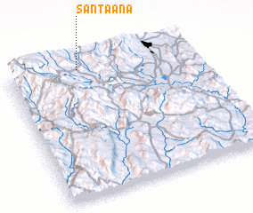 Places with similar names to Santa Ana, Mexico ::
Disclaimer :: Information on this page comes without warranty of any kind |
||
|
Where is Santa Ana? Elevation and coordinates ::
Latitude (lat): 18°58'0"N Longitude (lon): 99°37'0"W
Elevation (approx.): 2071m (map arrows pan, magnifying glasses zoom) |
||
|
Visiting Santa Ana? Hotel/Accommodation ::
Book a hotel in Santa Ana Travel Guide ::
Buy a travel guide for Mexico rental cars ::
car rental offers GPS waypoint ::
download a GPX waypoint (PoI) of Santa Ana for your GPS receiver
|
||