|
search place name
|
||
Santa Teresa (Guanajuato, Mexico)Santa Teresa is a town in the Guanajuato region of Mexico. An overview map of the region around Santa Teresa is displayed below.
regional and 3d topo map of Santa Teresa, Mexico ::

Santa Teresa airports ::
The nearest airport is BJX - Del Bajio Guanajuato Intl, located 60.8 km south west of Santa Teresa.
Other airports nearby include SLP - San Luis Potosi Ponciano Arriaga Intl (91.0 km north), AGU - Aguascalientes Jesus Teran Intl (120.4 km west), QRO - Queretaro Intercontinental (140.0 km south east), MLM - Morelia General Francisco J Mujica Intl (179.7 km south), Nearby towns ::
Los Díaz (1.6km north) //
Trojes de Aguirre (1.8km west) //
Tepeaca (3.6km north east) //
Guadalupe (4.0km south) //
San Felipe (3.9km north west) //
Llano del Cuervo (4.1km south east) //
Santa Elena (4.1km south west) //
La Joya (3.9km south west) //
Nopalera (4.4km south west) //
Piedras Negras (5.1km north west) //
Manzanillo (5.0km east) //
Manzanillas (5.0km east) //
La Huerta (5.6km south) //
Carreón (5.3km south east) //
Aranjuez (5.3km west) //
Palmitas (5.5km east) //
Camino Real (5.5km east) //
Gavilanes (5.5km east) //
Santa Fe (5.7km south east) //
San Antonio (6.2km south west) //
Fresno (6.4km north east) //
Las Palmas (7.0km west) //
El Pirul (7.1km west) //
San Isidro (7.1km east) //
El Aposento (7.6km south) //
La Ciénega (7.6km south west) //
Antonia (7.6km north west) //
Cuervo (7.6km south east) //
María Auxiliadora (8.2km north) //
[all distances 'as the bird flies' and approximate] 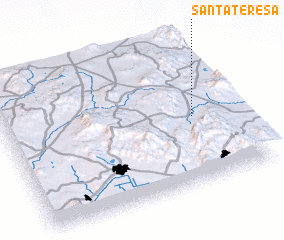 Places with similar names to Santa Teresa, Mexico ::
// Santa Teresa (BR)
// Santa Teresa (BR)
// Santa Teresa (BR)
// Santa Teresa (BR)
// Santa Teresa (BR)
// Santa Teresa (BR)
// Santa Teresa (BR)
// Santa Teresa (BR)
// Santa Teresa (BR)
// Santa Teresa (BR)
Disclaimer :: Information on this page comes without warranty of any kind |
||
|
Where is Santa Teresa? Elevation and coordinates ::
Latitude (lat): 21°28'0"N Longitude (lon): 101°11'0"W
Elevation (approx.): 2063m (map arrows pan, magnifying glasses zoom) |
||
|
Visiting Santa Teresa? Hotel/Accommodation ::
Book a hotel in Santa Teresa Travel Guide ::
Buy a travel guide for Mexico rental cars ::
car rental offers GPS waypoint ::
download a GPX waypoint (PoI) of Santa Teresa for your GPS receiver
|
||