|
search place name
|
||
Santa Teresa (Guanajuato, Mexico)Santa Teresa is a town in the Guanajuato region of Mexico. An overview map of the region around Santa Teresa is displayed below.
regional and 3d topo map of Santa Teresa, Mexico ::

Santa Teresa airports ::
The nearest airport is QRO - Queretaro Intercontinental, located 66.4 km south east of Santa Teresa.
Other airports nearby include BJX - Del Bajio Guanajuato Intl (75.3 km west), MLM - Morelia General Francisco J Mujica Intl (113.6 km south), SLP - San Luis Potosi Ponciano Arriaga Intl (156.5 km north), ZMM - Zamora (180.2 km south west), Nearby towns ::
Cañada de Begoña (0.5km south) //
Calderón (1.0km west) //
San Marcos (3.0km west) //
Las Flores (3.4km north west) //
Pantoja (3.4km north west) //
Presa de Allende (5.4km west) //
Soria (5.7km south west) //
La Huerta (6.0km south west) //
Las Flores (5.9km east) //
Don Juan (6.4km north west) //
Rinconcillo de Remedios (6.9km south) //
Calderón (6.9km south) //
El Hustan (7.1km south west) //
Agustín González (7.3km west) //
Rancho Nuevo (7.5km north west) //
San Miguel de Allende (8.0km north) //
Guerrero (8.1km north) //
Los Martínez (7.7km west) //
La Fracción (8.2km north) //
Morales (8.5km south west) //
El Refugio (8.8km south) //
La Aurora (8.7km north east) //
Alcocer (8.6km north east) //
Santa Teresa (8.9km north east) //
El Padre (9.4km north east) //
Aparicio (11.3km north east) //
[all distances 'as the bird flies' and approximate] 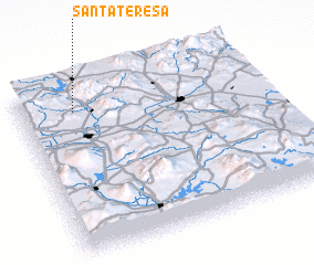 Places with similar names to Santa Teresa, Mexico ::
// Santa Teresa (BR)
// Santa Teresa (BR)
// Santa Teresa (BR)
// Santa Teresa (BR)
// Santa Teresa (BR)
// Santa Teresa (BR)
// Santa Teresa (BR)
// Santa Teresa (BR)
// Santa Teresa (BR)
// Santa Teresa (BR)
Disclaimer :: Information on this page comes without warranty of any kind |
||
|
Where is Santa Teresa? Elevation and coordinates ::
Latitude (lat): 20°50'54"N Longitude (lon): 100°46'25"W
Elevation (approx.): 1985m (map arrows pan, magnifying glasses zoom) |
||
|
Visiting Santa Teresa? Hotel/Accommodation ::
Book a hotel in Santa Teresa Travel Guide ::
Buy a travel guide for Mexico rental cars ::
car rental offers GPS waypoint ::
download a GPX waypoint (PoI) of Santa Teresa for your GPS receiver
|
||