|
search place name
|
||
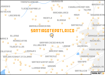
Santiago Tepatlaxco (México, Mexico)Santiago Tepatlaxco is a town in the México region of Mexico. An overview map of the region around Santiago Tepatlaxco is displayed below.
regional and 3d topo map of Santiago Tepatlaxco, Mexico ::
Santiago Tepatlaxco airports ::
The nearest airport is TLC - Toluca Licenciado Adolfo Lopez Mateos Intl, located 27.4 km south west of Santiago Tepatlaxco.
Other airports nearby include MEX - Mexico City Licenciado Benito Juarez Intl (29.1 km east), CVJ - Cuernavaca General Mariano Matamoros (71.0 km south), PCA - Pachuca Ingeniero Juan Guillermo Villasana (89.4 km north east), PBC - Puebla Hermanos Serdan Intl (108.2 km east), Nearby towns ::
San Francisco Chimalpa (3.0km south) //
San Luis Ayucán (3.6km north west) //
Magnolia (3.7km south east) //
Chimalpa (4.2km south) //
Barrio Las Manzanas (4.5km north west) //
El Guarda (5.1km south west) //
Barrio Las Manzanas (5.1km north west) //
Villa Alpina (5.7km south west) //
Mazatla (6.0km north) //
Alameda (6.0km north east) //
San Cristóbal (6.2km south) //
Magdalena Chichicaspa (6.3km south) //
Santa María Mazatla (6.5km north west) //
La Mesa (6.5km south east) //
Los Cuartos (7.3km east) //
El Guarda (7.6km south west) //
La Mesa (7.7km south east) //
Santa Cruz (7.9km south) //
San Crisóbal Texcalucan (8.2km south) //
Rancho Blanco (8.3km north) //
Loma Colorada (8.2km east) //
Los Remedios (8.2km east) //
Espíritu Santo (8.6km north west) //
Jardines de San Mateo (8.4km east) //
Chiluca (8.9km north east) //
San Bartolomé Coatepec (9.2km south east) //
San Miguel Tecpan (9.3km north west) //
Santa Ana Jilotzingo (9.5km north west) //
Las Rajas (9.4km south west) //
[all distances 'as the bird flies' and approximate]  Places with similar names to Santiago Tepatlaxco, Mexico :: Disclaimer :: Information on this page comes without warranty of any kind |
||
|
Where is Santiago Tepatlaxco? Elevation and coordinates ::
Latitude (lat): 19°28'15"N Longitude (lon): 99°20'49"W
Elevation (approx.): 2841m (map arrows pan, magnifying glasses zoom) |
||
|
Visiting Santiago Tepatlaxco? Hotel/Accommodation ::
Book a hotel in Santiago Tepatlaxco Travel Guide ::
Buy a travel guide for Mexico rental cars ::
car rental offers GPS waypoint ::
download a GPX waypoint (PoI) of Santiago Tepatlaxco for your GPS receiver
|
||