|
search place name
|
||
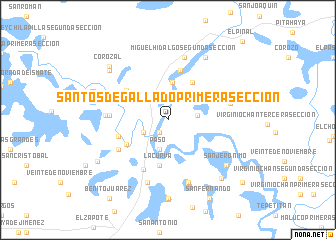
Santos Degallado Primera Sección (Tabasco, Mexico)Santos Degallado Primera Sección is a town in the Tabasco region of Mexico. An overview map of the region around Santos Degallado Primera Sección is displayed below.
regional and 3d topo map of Santos Degallado Primera Sección, Mexico ::
Santos Degallado Primera Sección airports ::
The nearest airport is VSA - Villahermosa C P A Carlos Rovirosa Intl, located 37.5 km west of Santos Degallado Primera Sección.
Other airports nearby include CME - Ciudad Del Carmen Intl (108.8 km north east), TGZ - Tuxtla Gutierrez Angel Albino Corzo (160.6 km south), CPE - Campeche Ingeniero Alberto Acuna Ongay Intl (296.2 km north east), Nearby towns ::
Jobo (1.6km south west) //
Ciudad Pemex (3.0km south west) //
Santos Degallado Segunda Sección (3.1km east) //
Paso (3.4km south) //
Miguel Cotoneo (4.2km north) //
Encrucijada (4.9km north east) //
La Curva (5.2km south) //
El Limón (5.2km south west) //
Chilapilla Segunda Sección (5.5km north west) //
Miguel Hidalgo Primera Sección (5.7km north) //
Vernet Sexta Sección (5.6km west) //
El Limón Segunda Sección (6.2km south west) //
Vernet Primera Sección (6.2km south west) //
Buenavista (6.2km west) //
Santa Elena (6.6km east) //
Vernet Corozal Quinta Sección (6.6km west) //
Miguel Hidalgo Segunda Sección (7.2km north) //
Miguel Orrico de los Llanos (6.9km east) //
La Isla Primera Sección (7.3km south) //
La Unión (7.3km south) //
El Bejucal (8.0km north east) //
San Jerónimo (8.0km south east) //
Chilapilla Primera Sección (8.3km north west) //
Carmen Serdan (8.8km south) //
Francisco Bates (8.7km south east) //
Corozal (8.6km north west) //
Vernet Segunda Sección (8.8km south west) //
San Fernando (9.8km south east) //
Trinidad (10.5km south east) //
[all distances 'as the bird flies' and approximate] 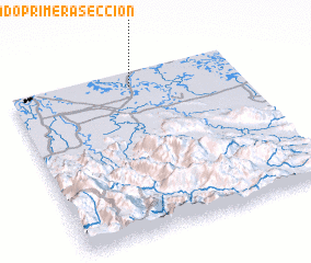 Places with similar names to Santos Degallado Primera Sección, Mexico :: Disclaimer :: Information on this page comes without warranty of any kind |
||
|
Where is Santos Degallado Primera Sección? Elevation and coordinates ::
Latitude (lat): 17°54'45"N Longitude (lon): 92°28'30"W
Elevation (approx.): 3m (map arrows pan, magnifying glasses zoom) |
||
|
Visiting Santos Degallado Primera Sección? Hotel/Accommodation ::
Book a hotel in Santos Degallado Primera Sección Travel Guide ::
Buy a travel guide for Mexico rental cars ::
car rental offers GPS waypoint ::
download a GPX waypoint (PoI) of Santos Degallado Primera Sección for your GPS receiver
|
||