|
search place name
|
||
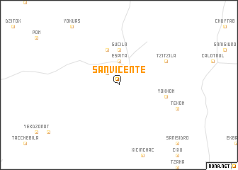
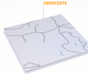
San Vicente (Yucatán, Mexico)San Vicente is a town in the Yucatán region of Mexico. An overview map of the region around San Vicente is displayed below.
regional and 3d topo map of San Vicente, Mexico ::
San Vicente airports ::
The nearest airport is MID - Merida Licenciado Manuel Crescencio Rejon Int, located 139.6 km west of San Vicente.
Other airports nearby include CUN - Cancun Intl (149.8 km east), CZM - Cozumel Intl (153.6 km east), ISJ - Isla Mujeres (166.3 km east), Nearby towns ::
 Places with similar names to San Vicente, Mexico ::
// San Vicente (US)
// San Vicente (PA)
// San Vicente (PA)
// San Vicente (CU)
// San Vicente (CU)
// San Vicente (CU)
// San Vicente (CU)
// San Vicente (CU)
// San Vicente (CU)
// San Vicente (CU)
Disclaimer :: Information on this page comes without warranty of any kind |
||
|
Where is San Vicente? Elevation and coordinates ::
Latitude (lat): 20°59'0"N Longitude (lon): 88°19'0"W
Elevation (approx.): 27m (map arrows pan, magnifying glasses zoom) |
||
|
Visiting San Vicente? Hotel/Accommodation ::
Book a hotel in San Vicente Travel Guide ::
Buy a travel guide for Mexico rental cars ::
car rental offers GPS waypoint ::
download a GPX waypoint (PoI) of San Vicente for your GPS receiver
|
||