|
search place name
|
||
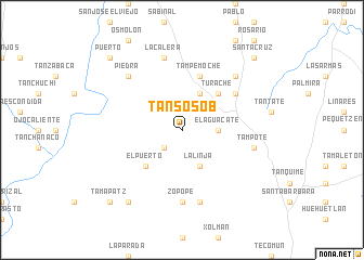
Tansosob (San Luis Potosí, Mexico)Tansosob is a town in the San Luis Potosí region of Mexico. An overview map of the region around Tansosob is displayed below.
regional and 3d topo map of Tansosob, Mexico ::
Tansosob airports ::
The nearest airport is TSL - Tamuin, located 52.6 km north east of Tansosob.
Other airports nearby include TAM - Tampico General Francisco Javier Mina Intl (146.2 km north east), QRO - Queretaro Intercontinental (160.6 km south west), PCA - Pachuca Ingeniero Juan Guillermo Villasana (177.2 km south), SLP - San Luis Potosi Ponciano Arriaga Intl (200.6 km west), Nearby towns ::
Yerbabuena (2.5km south west) //
El Aguacate (3.4km east) //
La Linja (4.1km south east) //
Puhuitze (4.1km north east) //
Turache (5.1km north east) //
El Puerto (5.1km south west) //
Tampemoche (5.8km north) //
Tanchanaco (6.4km north east) //
Zopope (7.4km south) //
Paxalja (7.6km south) //
Aquismón (7.1km east) //
Tampote (7.1km east) //
La Calera (7.6km north) //
Rancho Nuevo (7.6km north east) //
El Otate (7.6km north west) //
Piedra (7.6km north west) //
El Clavo (9.0km south west) //
Tamapatz (10.1km south west) //
Puerto (10.1km north west) //
Santa Cruz (10.1km north east) //
[all distances 'as the bird flies' and approximate] 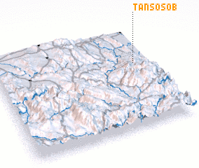 Places with similar names to Tansosob, Mexico :: Disclaimer :: Information on this page comes without warranty of any kind |
||
|
Where is Tansosob? Elevation and coordinates ::
Latitude (lat): 21°39'0"N Longitude (lon): 99°6'0"W
Elevation (approx.): 774m (map arrows pan, magnifying glasses zoom) |
||
|
Visiting Tansosob? Hotel/Accommodation ::
Book a hotel in Tansosob Travel Guide ::
Buy a travel guide for Mexico rental cars ::
car rental offers GPS waypoint ::
download a GPX waypoint (PoI) of Tansosob for your GPS receiver
|
||