|
search place name
|
||
Taragundi (Oaxaca, Mexico)Taragundi is a town in the Oaxaca region of Mexico. An overview map of the region around Taragundi is displayed below.
regional and 3d topo map of Taragundi, Mexico ::

Taragundi airports ::
The nearest airport is OAX - Oaxaca Xoxocotlan Intl, located 54.6 km north west of Taragundi.
Other airports nearby include HUX - Bahias Dehuatulco Bahias De Huatulco Intl (107.9 km south), PXM - Puerto Escondido Intl (129.4 km south west), TCN - Tehuacan (227.8 km north west), MTT - Minatitlan (235.0 km north east), Nearby towns ::
Santo Tomás de Arriba (5.7km north) //
San Juanico (6.0km south) //
San Baltazar Guelavila (6.3km north west) //
Santo Tomás de Arriba (6.7km north east) //
Lachivelde (8.0km south east) //
San Juan Guedoyachi (9.0km south) //
[all distances 'as the bird flies' and approximate] 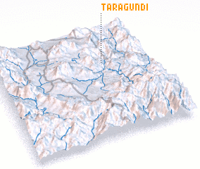 Places with similar names to Taragundi, Mexico ::
// Tri Kondy (RU)
// Targant (MA)
// Targant (MA)
// Tirknit (MA)
// Dreckente (DE)
// Dragonetti (IT)
// Dirkintai (LT)
// Darıkent (TR)
// Dragonte (ES)
// Torquiendo (ES)
Disclaimer :: Information on this page comes without warranty of any kind |
||
|
Where is Taragundi? Elevation and coordinates ::
Latitude (lat): 16°45'2"N Longitude (lon): 96°17'6"W
Elevation (approx.): 1571m (map arrows pan, magnifying glasses zoom) |
||
|
Visiting Taragundi? Hotel/Accommodation ::
Book a hotel in Taragundi Travel Guide ::
Buy a travel guide for Mexico rental cars ::
car rental offers GPS waypoint ::
download a GPX waypoint (PoI) of Taragundi for your GPS receiver
|
||