|
search place name
|
||
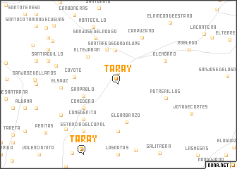
Taray (Guanajuato, Mexico)Taray is a town in the Guanajuato region of Mexico. An overview map of the region around Taray is displayed below.
regional and 3d topo map of Taray, Mexico ::
Taray airports ::
The nearest airport is BJX - Del Bajio Guanajuato Intl, located 34.8 km north west of Taray.
Other airports nearby include QRO - Queretaro Intercontinental (107.1 km east), MLM - Morelia General Francisco J Mujica Intl (111.9 km south), ZMM - Zamora (144.7 km south west), AGU - Aguascalientes Jesus Teran Intl (151.1 km north west), Nearby towns ::
San Gregorio (1.9km north) //
Santa Fe de Guadalupe (5.4km north) //
La Sauceda (5.8km north) //
San Pablo (5.5km west) //
El Garbanzo (6.1km south) //
El Tejabán (6.3km north west) //
Comedero (6.4km south west) //
Coyote (6.6km west) //
Santa Rosa (7.4km south) //
Potrerillos (7.3km east) //
Comederito (7.6km south west) //
San José del Rodeo (8.0km north west) //
El Chorro (7.9km north east) //
Campuzano (8.2km north east) //
Estancia del Copal (9.1km south west) //
El Encino (10.5km south west) //
Santa Rosa de la Cruz (10.9km south west) //
[all distances 'as the bird flies' and approximate]  Places with similar names to Taray, Mexico ::
Disclaimer :: Information on this page comes without warranty of any kind |
||
|
Where is Taray? Elevation and coordinates ::
Latitude (lat): 20°51'0"N Longitude (lon): 101°11'0"W
Elevation (approx.): 2066m (map arrows pan, magnifying glasses zoom) |
||
|
Visiting Taray? Hotel/Accommodation ::
Book a hotel in Taray Travel Guide ::
Buy a travel guide for Mexico rental cars ::
car rental offers GPS waypoint ::
download a GPX waypoint (PoI) of Taray for your GPS receiver
|
||