|
search place name
|
||
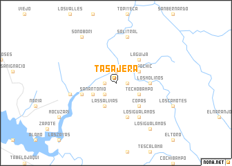
Tasajera (Sonora, Mexico)Tasajera is a town in the Sonora region of Mexico. An overview map of the region around Tasajera is displayed below.
regional and 3d topo map of Tasajera, Mexico ::
Tasajera airports ::
The nearest airport is CEN - Ciudad Obregon Intl, located 91.3 km west of Tasajera.
Other airports nearby include LMM - Los Mochis Valle Del Fuerte Intl (179.7 km south), Nearby towns ::
Buenavista (1.6km west) //
Laguna (1.6km east) //
Macoyahui (1.9km north) //
Los Cuates (2.5km south west) //
Las Salvias (4.1km south west) //
San Antonio (3.8km south west) //
Tetapochic (3.8km north east) //
El Porvenir (3.8km south east) //
Techobampo (3.8km south east) //
La Guija (5.0km north east) //
Copas (5.0km south east) //
Los Molinos (4.9km east) //
La Venata (5.8km south) //
Cupis (5.3km west) //
Los Igualamos (6.5km south east) //
Guacaporo (6.8km west) //
Salitral (7.6km north) //
Los Igualamos (8.9km south east) //
Sonoborí (8.9km north west) //
[all distances 'as the bird flies' and approximate] 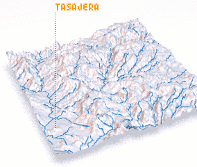 Places with similar names to Tasajera, Mexico ::
Disclaimer :: Information on this page comes without warranty of any kind |
||
|
Where is Tasajera? Elevation and coordinates ::
Latitude (lat): 27°18'0"N Longitude (lon): 108°55'0"W
Elevation (approx.): 181m (map arrows pan, magnifying glasses zoom) |
||
|
Visiting Tasajera? Hotel/Accommodation ::
Book a hotel in Tasajera Travel Guide ::
Buy a travel guide for Mexico rental cars ::
car rental offers GPS waypoint ::
download a GPX waypoint (PoI) of Tasajera for your GPS receiver
|
||