|
search place name
|
||
Temamatla (México, Mexico)Temamatla is a town in the México region of Mexico. An overview map of the region around Temamatla is displayed below.
regional and 3d topo map of Temamatla, Mexico ::

Temamatla airports ::
The nearest airport is MEX - Mexico City Licenciado Benito Juarez Intl, located 32.8 km north west of Temamatla.
Other airports nearby include PBC - Puebla Hermanos Serdan Intl (54.0 km east), CVJ - Cuernavaca General Mariano Matamoros (56.7 km south west), TLC - Toluca Licenciado Adolfo Lopez Mateos Intl (73.4 km west), TXA - Tlaxcala (83.4 km north east), Nearby towns ::
Temamatla (NaNkm north) //
Los Reyes Acatlizhuayan (1.8km west) //
El Paraíso (2.5km south east) //
San Pablo Atlazalpan (2.5km north west) //
Asunción (2.5km north west) //
Santiago Zula (2.8km north) //
Cocotitlán (4.1km north east) //
San Mateo Huitzilzingo (4.5km north west) //
Bellavista (5.0km north) //
Tenango del Aire (5.1km south east) //
Guadalupe (5.1km north east) //
San Lorenzo Chimalpa (5.1km north west) //
San Martín Xico Nuevo (5.3km north west) //
Santa Catarina Ayotzingo (5.3km west) //
San Pedro Tezompa (5.3km west) //
San Andrés Metla (5.6km east) //
Toxtlitepet (5.6km east) //
La Candelaria Tlapala (5.7km north east) //
San Mateo Tepopula (6.6km south east) //
San Gregorio Cuautzingo (6.6km north east) //
Paso de Huichila (7.2km east) //
Chalco de Díaz Covarrubias (7.6km north) //
San Lucas Amalinalco (8.1km north) //
San Miguel Xico (8.0km north west) //
Tlaltelolco (8.2km south east) //
Emiliano Zapata (8.3km north) //
San Mateo Tezoquipan (8.1km east) //
San Juan Coxtocan (8.6km south east) //
Tlamapa (8.9km south east) //
[all distances 'as the bird flies' and approximate] 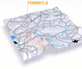 Places with similar names to Temamatla, Mexico ::
// Temamatla (MX)
Disclaimer :: Information on this page comes without warranty of any kind |
||
|
Where is Temamatla? Elevation and coordinates ::
Latitude (lat): 19°12'0"N Longitude (lon): 98°53'0"W
Elevation (approx.): 2272m (map arrows pan, magnifying glasses zoom) |
||
|
Visiting Temamatla? Hotel/Accommodation ::
Book a hotel in Temamatla Travel Guide ::
Buy a travel guide for Mexico rental cars ::
car rental offers GPS waypoint ::
download a GPX waypoint (PoI) of Temamatla for your GPS receiver
|
||