|
search place name
|
||
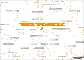
Temascaltepec de González (México, Mexico)Temascaltepec de González is a town in the México region of Mexico. An overview map of the region around Temascaltepec de González is displayed below.
regional and 3d topo map of Temascaltepec de González, Mexico ::
Temascaltepec de González airports ::
The nearest airport is TLC - Toluca Licenciado Adolfo Lopez Mateos Intl, located 61.0 km north east of Temascaltepec de González.
Other airports nearby include CVJ - Cuernavaca General Mariano Matamoros (85.9 km east), MEX - Mexico City Licenciado Benito Juarez Intl (112.1 km north east), MLM - Morelia General Francisco J Mujica Intl (136.6 km north west), QRO - Queretaro Intercontinental (175.9 km north), Nearby towns ::
Estancia Vieja (0.6km south east) //
Mina de Agua (2.0km south east) //
Los Timbres (2.0km north west) //
El Tule (3.6km west) //
Los Berros Cuentla (3.9km south) //
Albarradas (4.1km north west) //
San Simón de Guerrero (4.5km east) //
Cucha (5.1km south east) //
Godínez (5.6km north) //
Buenavista (5.8km south) //
San Lucas del Pulque (5.8km north) //
Tehuastepec (7.2km north) //
San Gabriel Cuentla (7.4km south) //
Las Mesas (7.1km east) //
Carboneras (7.2km east) //
El Monte (7.5km south east) //
La Serrita (7.7km south east) //
El Peñón (7.5km west) //
San Simón de Guerrero (8.2km south east) //
Teneriía (8.2km south west) //
Real de Arriba (7.9km south east) //
El Monte (7.9km south east) //
Río Grande (8.1km west) //
Peña Redonda (8.7km south) //
San Andrés de los Gama (8.3km east) //
Los Jaramillos (9.1km north west) //
San José Potrerillos (9.5km north west) //
Rancho Viejo (9.9km south east) //
Jesús del Monte (10.2km north east) //
[all distances 'as the bird flies' and approximate] 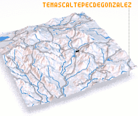 Places with similar names to Temascaltepec de González, Mexico :: Disclaimer :: Information on this page comes without warranty of any kind |
||
|
Where is Temascaltepec de González? Elevation and coordinates ::
Latitude (lat): 19°2'0"N Longitude (lon): 100°3'0"W
Elevation (approx.): 2012m (map arrows pan, magnifying glasses zoom) |
||
|
Visiting Temascaltepec de González? Hotel/Accommodation ::
Book a hotel in Temascaltepec de González Travel Guide ::
Buy a travel guide for Mexico rental cars ::
car rental offers GPS waypoint ::
download a GPX waypoint (PoI) of Temascaltepec de González for your GPS receiver
|
||