|
search place name
|
||
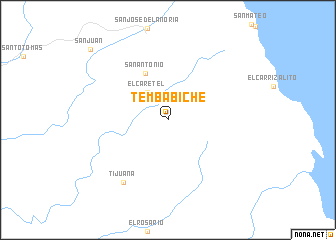
Tembabiche (Baja California Sur, Mexico)Tembabiche is a town in the Baja California Sur region of Mexico. An overview map of the region around Tembabiche is displayed below.
regional and 3d topo map of Tembabiche, Mexico ::
Tembabiche airports ::
The nearest airport is LTO - Loreto Intl, located 79.4 km north of Tembabiche.
Other airports nearby include LAP - La Paz General Manuel Marquez De Leon Intl (155.8 km south east), Nearby towns ::
Tembabiche (0.0km north) //
El Caretel (3.7km north west) //
San Antonio (5.6km north west) //
Tijuana (8.3km south west) //
San Juan (11.1km north west) //
[all distances 'as the bird flies' and approximate] 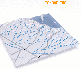 Places with similar names to Tembabiche, Mexico ::
// Tembabiche (MX)
// Tommy Bush (JM)
Disclaimer :: Information on this page comes without warranty of any kind |
||
|
Where is Tembabiche? Elevation and coordinates ::
Latitude (lat): 25°18'45"N Longitude (lon): 111°5'20"W
Elevation (approx.): 679m (map arrows pan, magnifying glasses zoom) |
||
|
Visiting Tembabiche? Hotel/Accommodation ::
Book a hotel in Tembabiche Travel Guide ::
Buy a travel guide for Mexico rental cars ::
car rental offers GPS waypoint ::
download a GPX waypoint (PoI) of Tembabiche for your GPS receiver
|
||