|
search place name
|
||
Tenjay (Hidalgo, Mexico)Tenjay is a town in the Hidalgo region of Mexico. An overview map of the region around Tenjay is displayed below.
regional and 3d topo map of Tenjay, Mexico ::

Tenjay airports ::
The nearest airport is PCA - Pachuca Ingeniero Juan Guillermo Villasana, located 61.1 km east of Tenjay.
Other airports nearby include MEX - Mexico City Licenciado Benito Juarez Intl (78.0 km south east), TLC - Toluca Licenciado Adolfo Lopez Mateos Intl (85.2 km south), QRO - Queretaro Intercontinental (104.0 km north west), CVJ - Cuernavaca General Mariano Matamoros (138.7 km south), Nearby towns ::
San Francisco Bojay (1.7km east) //
Nantzhá (2.2km north west) //
Xitejé de Zapote (2.3km north west) //
Santa Ana Ahuehuepan (2.5km north east) //
San Andrés (3.7km south) //
Michimaloya (3.5km west) //
Tula de Allende (4.1km south east) //
San Marcos (3.9km south east) //
Julián Villagrán (3.9km north east) //
Xijay de Cuauhtémoc (4.8km north west) //
Iturbe (4.9km east) //
El Paso (5.1km south west) //
San Lorenzo (5.1km south east) //
San Antonio Tula (6.0km west) //
Xochitlán (6.1km west) //
San Marcos (6.6km south east) //
San Pedro Alpuyeca (6.8km south east) //
El Ocotal (7.4km south) //
San Antonio (7.0km west) //
San Pedro Nextlalpan (7.4km north) //
San Miguel (7.2km west) //
General Pedro María Apaya (7.6km north) //
San Mateo (7.6km north) //
El Llano (7.9km south east) //
El Llano (8.0km south east) //
Ignacio Zaragoza (8.8km south east) //
Jasso (9.1km south east) //
La Magdalena (8.9km south west) //
Las Canoas (11.0km south west) //
[all distances 'as the bird flies' and approximate] 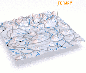 Places with similar names to Tenjay, Mexico ::
Disclaimer :: Information on this page comes without warranty of any kind |
||
|
Where is Tenjay? Elevation and coordinates ::
Latitude (lat): 20°5'0"N Longitude (lon): 99°22'0"W
Elevation (approx.): 2132m (map arrows pan, magnifying glasses zoom) |
||
|
Visiting Tenjay? Hotel/Accommodation ::
Book a hotel in Tenjay Travel Guide ::
Buy a travel guide for Mexico rental cars ::
car rental offers GPS waypoint ::
download a GPX waypoint (PoI) of Tenjay for your GPS receiver
|
||