|
search place name
|
||
Tepehuajes (Tamaulipas, Mexico)Tepehuajes is a town in the Tamaulipas region of Mexico. An overview map of the region around Tepehuajes is displayed below.
regional and 3d topo map of Tepehuajes, Mexico ::

Tepehuajes airports ::
The nearest airport is CEN - Ciudad Obregon Intl, located 118.8 km north west of Tepehuajes.
Other airports nearby include LMM - Los Mochis Valle Del Fuerte Intl (142.2 km south), Nearby towns ::
Laborcita (4.1km south east) //
Guayabo (5.6km north) //
Otates (5.3km east) //
Las Plomosas (5.8km north) //
La Majada (6.2km north west) //
El Palmarito (7.6km north) //
La Noria (7.4km north west) //
La Labor (7.6km south west) //
Las Pilas (8.1km north west) //
Potrero Otero (8.1km north west) //
Mezquital (7.6km south west) //
Choquincahui (8.6km north east) //
Quirocoba (8.6km south east) //
El Sabino (9.0km north west) //
[all distances 'as the bird flies' and approximate] 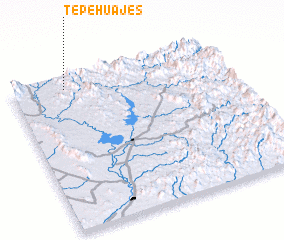 Places with similar names to Tepehuajes, Mexico ::
// Tepehuajes (MX)
Disclaimer :: Information on this page comes without warranty of any kind |
||
|
Where is Tepehuajes? Elevation and coordinates ::
Latitude (lat): 26°56'0"N Longitude (lon): 108°45'0"W
Elevation (approx.): 637m (map arrows pan, magnifying glasses zoom) |
||
|
Visiting Tepehuajes? Hotel/Accommodation ::
Book a hotel in Tepehuajes Travel Guide ::
Buy a travel guide for Mexico rental cars ::
car rental offers GPS waypoint ::
download a GPX waypoint (PoI) of Tepehuajes for your GPS receiver
|
||