|
search place name
|
||
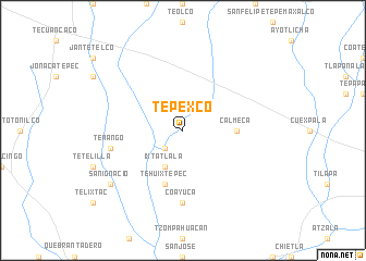
Tepexco (Puebla, Mexico)Tepexco is a town in the Puebla region of Mexico. An overview map of the region around Tepexco is displayed below.
regional and 3d topo map of Tepexco, Mexico ::
Tepexco airports ::
The nearest airport is CVJ - Cuernavaca General Mariano Matamoros, located 64.9 km west of Tepexco.
Other airports nearby include PBC - Puebla Hermanos Serdan Intl (66.7 km north east), MEX - Mexico City Licenciado Benito Juarez Intl (97.9 km north west), TXA - Tlaxcala (113.6 km north east), TLC - Toluca Licenciado Adolfo Lopez Mateos Intl (121.3 km north west), Nearby towns ::
Tlazola (2.6km south west) //
Ixtatlala (4.1km south west) //
Calmeca (5.3km east) //
Tehuixtepec (5.8km south) //
Coayuca (7.4km south) //
Tenango (7.3km west) //
San Ignacio (9.0km south west) //
[all distances 'as the bird flies' and approximate] 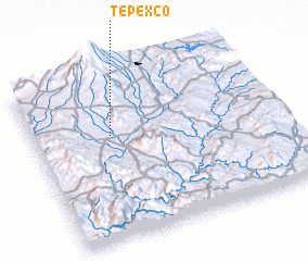 Places with similar names to Tepexco, Mexico ::
Disclaimer :: Information on this page comes without warranty of any kind |
||
|
Where is Tepexco? Elevation and coordinates ::
Latitude (lat): 18°38'0"N Longitude (lon): 98°41'0"W
Elevation (approx.): 1188m (map arrows pan, magnifying glasses zoom) |
||
|
Visiting Tepexco? Hotel/Accommodation ::
Book a hotel in Tepexco Travel Guide ::
Buy a travel guide for Mexico rental cars ::
car rental offers GPS waypoint ::
download a GPX waypoint (PoI) of Tepexco for your GPS receiver
|
||