|
search place name
|
||
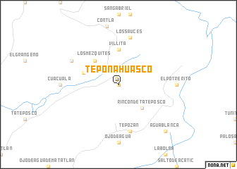
Teponahuasco (Jalisco, Mexico)Teponahuasco is a town in the Jalisco region of Mexico. An overview map of the region around Teponahuasco is displayed below.
regional and 3d topo map of Teponahuasco, Mexico ::
Teponahuasco airports ::
The nearest airport is GDL - Guadalajara Don Miguel Hidalgo Y Costilla Intl, located 52.4 km south west of Teponahuasco.
Other airports nearby include AGU - Aguascalientes Jesus Teran Intl (114.6 km north east), ZMM - Zamora (124.7 km south east), BJX - Del Bajio Guanajuato Intl (161.7 km east), CLQ - Colima (190.2 km south), Nearby towns ::
Cuquío (0.0km north) //
Rincón de Tateposco (5.1km south east) //
Los Mezquites (5.1km north west) //
Villita (5.6km north) //
El Aguacate (5.5km west) //
Los Sauces (7.6km north) //
Tepozán (7.6km south) //
Las Ánimas (7.9km north west) //
Agua Blanca (10.1km south east) //
[all distances 'as the bird flies' and approximate] 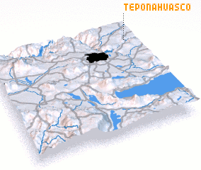 Places with similar names to Teponahuasco, Mexico :: Disclaimer :: Information on this page comes without warranty of any kind |
||
|
Where is Teponahuasco? Elevation and coordinates ::
Latitude (lat): 20°55'0"N Longitude (lon): 103°2'0"W
Elevation (approx.): 1907m (map arrows pan, magnifying glasses zoom) |
||
|
Visiting Teponahuasco? Hotel/Accommodation ::
Book a hotel in Teponahuasco Travel Guide ::
Buy a travel guide for Mexico rental cars ::
car rental offers GPS waypoint ::
download a GPX waypoint (PoI) of Teponahuasco for your GPS receiver
|
||