|
search place name
|
||
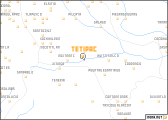
Tetipac (Guerrero, Mexico)Tetipac is a town in the Guerrero region of Mexico. An overview map of the region around Tetipac is displayed below.
regional and 3d topo map of Tetipac, Mexico ::
Tetipac airports ::
The nearest airport is CVJ - Cuernavaca General Mariano Matamoros, located 47.4 km north east of Tetipac.
Other airports nearby include TLC - Toluca Licenciado Adolfo Lopez Mateos Intl (76.8 km north), MEX - Mexico City Licenciado Benito Juarez Intl (107.2 km north east), PBC - Puebla Hermanos Serdan Intl (147.6 km north east), PCA - Pachuca Ingeniero Juan Guillermo Villasana (183.3 km north east), Nearby towns ::
Tlachichilpan (1.9km north) //
Noxtepec (3.5km west) //
Huitzitzilco (5.3km east) //
Puerta de Santiago (5.5km south east) //
Tensisapan (5.8km south) //
Xitinga (5.6km west) //
Xocotitlán (7.3km west) //
Tenería (7.7km south west) //
Xochimilpan (7.9km north west) //
Salado (8.2km north east) //
[all distances 'as the bird flies' and approximate] 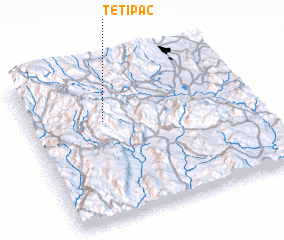 Places with similar names to Tetipac, Mexico ::
// Tatpok (MM)
// Tatapaca (CO)
// Teotepeque (SV)
// Teitipac (MX)
// Teotepec (MX)
// Titipac (MX)
// Tuta Paqui (PE)
// Tutupaca (PE)
// Tātpük (MM)
// Totopiak (PH)
Disclaimer :: Information on this page comes without warranty of any kind |
||
|
Where is Tetipac? Elevation and coordinates ::
Latitude (lat): 18°39'0"N Longitude (lon): 99°40'0"W
Elevation (approx.): 1676m (map arrows pan, magnifying glasses zoom) |
||
|
Visiting Tetipac? Hotel/Accommodation ::
Book a hotel in Tetipac Travel Guide ::
Buy a travel guide for Mexico rental cars ::
car rental offers GPS waypoint ::
download a GPX waypoint (PoI) of Tetipac for your GPS receiver
|
||