|
search place name
|
||
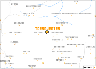
Tres Puentes (Chiapas, Mexico)Tres Puentes is a town in the Chiapas region of Mexico. An overview map of the region around Tres Puentes is displayed below.
regional and 3d topo map of Tres Puentes, Mexico ::
Tres Puentes airports ::
The nearest airport is TGZ - Tuxtla Gutierrez Angel Albino Corzo, located 50.6 km south west of Tres Puentes.
Other airports nearby include VSA - Villahermosa C P A Carlos Rovirosa Intl (117.9 km north), CME - Ciudad Del Carmen Intl (215.5 km north east), MTT - Minatitlan (233.6 km north west), Nearby towns ::
Tiamnal (2.0km south east) //
Santiago (3.5km west) //
Magdalenas (3.5km east) //
Talonquitz (4.5km south east) //
Larrainzar (5.8km south) //
Santa Marta (6.5km north east) //
Larrainzar (7.1km south east) //
Aldama (7.8km east) //
Callejón San Andrés (9.1km south east) //
Plátanos (9.1km north west) //
Puerto Cate (10.3km north west) //
Yalten (10.9km south west) //
[all distances 'as the bird flies' and approximate]  Places with similar names to Tres Puentes, Mexico ::
// Tres Puntas (PA)
// Trespuentes (ES)
// Tres Puentes (CL)
// Tres Puentes (CL)
// Tres Puentes (CL)
// Tres Puntas (CL)
// Tres Puntas (CO)
// Tres Puentes (GT)
// Toros Pintos (MX)
// Tres Puntes (MX)
Disclaimer :: Information on this page comes without warranty of any kind |
||
|
Where is Tres Puentes? Elevation and coordinates ::
Latitude (lat): 16°56'0"N Longitude (lon): 92°45'0"W
Elevation (approx.): 1749m (map arrows pan, magnifying glasses zoom) |
||
|
Visiting Tres Puentes? Hotel/Accommodation ::
Book a hotel in Tres Puentes Travel Guide ::
Buy a travel guide for Mexico rental cars ::
car rental offers GPS waypoint ::
download a GPX waypoint (PoI) of Tres Puentes for your GPS receiver
|
||