|
search place name
|
||
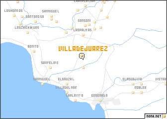
Villa de Juárez (Baja California, Mexico)Villa de Juárez is a town in the Baja California region of Mexico. An overview map of the region around Villa de Juárez is displayed below.
regional and 3d topo map of Villa de Juárez, Mexico ::
Villa de Juárez airports ::
The nearest airport is ESE - Ensenada, located 17.7 km south of Villa de Juárez.
Other airports nearby include TIJ - Tijuana General Abelardo L Rodriguez Intl (72.2 km north west), NZY - San Diego North Island Nas (98.7 km north west), SAN - San Diego Intl (100.7 km north west), NKX - Miramar Mcas (111.9 km north west), Nearby towns ::
San Antonio de las Minas (1.9km south) //
Las Palmas (5.6km north) //
El Sauzal (6.4km south west) //
San Marcos (6.9km north west) //
San Pablo (7.2km north) //
San Marcos (7.4km north) //
Sansoni (7.6km north) //
San Felipe (6.6km west) //
Chivato (7.9km north) //
Barre (7.9km north east) //
Villa del Mar (8.1km south west) //
San Pedro (8.7km north) //
Cubillas (10.0km north west) //
[all distances 'as the bird flies' and approximate]  Places with similar names to Villa de Juárez, Mexico ::
Disclaimer :: Information on this page comes without warranty of any kind |
||
|
Where is Villa de Juárez? Elevation and coordinates ::
Latitude (lat): 31°57'0"N Longitude (lon): 116°39'0"W
Elevation (approx.): 322m (map arrows pan, magnifying glasses zoom) |
||
|
Visiting Villa de Juárez? Hotel/Accommodation ::
Book a hotel in Villa de Juárez Travel Guide ::
Buy a travel guide for Mexico rental cars ::
car rental offers GPS waypoint ::
download a GPX waypoint (PoI) of Villa de Juárez for your GPS receiver
|
||