|
search place name
|
||
Villa Madero (Durango, Mexico)Villa Madero is a town in the Durango region of Mexico. An overview map of the region around Villa Madero is displayed below.
regional and 3d topo map of Villa Madero, Mexico ::

Villa Madero airports ::
The nearest airport is DGO - Durango Intl, located 36.4 km south west of Villa Madero.
Other airports nearby include TRC - Torreon Intl (159.5 km north east), ZCL - Zacatecas General Leobardo C Ruiz Intl (236.5 km south east), MZT - Mazatlan General Rafael Buelna Intl (240.0 km south west), Nearby towns ::
San Gabriel (1.7km east) //
Enrique Calderón (4.1km south west) //
La Galera (4.1km north west) //
Santa Rita (6.3km south east) //
La San Juanera (6.5km south west) //
La Noria (6.5km north west) //
Guadalajara (7.4km south) //
JoséJerónimo Hernandez (7.0km east) //
[all distances 'as the bird flies' and approximate] 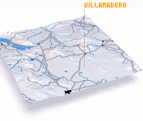 Places with similar names to Villa Madero, Mexico ::
// Villamudria (ES)
// Villa Madero (MX)
// Valāmdar (IR)
// Ghalamdarra (PK)
// Vieil-Moutier (FR)
// Villematier (FR)
// Villemotier (FR)
// Val Madre (IT)
// Villa Madero (AR)
// Villa Matará (AR)
Disclaimer :: Information on this page comes without warranty of any kind |
||
|
Where is Villa Madero? Elevation and coordinates ::
Latitude (lat): 24°24'0"N Longitude (lon): 104°20'0"W
Elevation (approx.): 1952m (map arrows pan, magnifying glasses zoom) |
||
|
Visiting Villa Madero? Hotel/Accommodation ::
Book a hotel in Villa Madero Travel Guide ::
Buy a travel guide for Mexico rental cars ::
car rental offers GPS waypoint ::
download a GPX waypoint (PoI) of Villa Madero for your GPS receiver
|
||