|
search place name
|
||
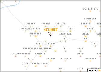
Xcumac (Yucatán, Mexico)Xcumac is a town in the Yucatán region of Mexico. An overview map of the region around Xcumac is displayed below.
regional and 3d topo map of Xcumac, Mexico ::
Xcumac airports ::
The nearest airport is MID - Merida Licenciado Manuel Crescencio Rejon Int, located 25.1 km south east of Xcumac.
Other airports nearby include CPE - Campeche Ingeniero Alberto Acuna Ongay Intl (151.7 km south west), Nearby towns ::
San Eduardo (2.5km south west) //
Hunucmá (3.7km south) //
Tacubaya (4.1km north west) //
Bella Unión (3.9km north east) //
Buenavista (3.9km north east) //
Xcucul (3.9km south east) //
Nabanché (5.1km south west) //
Chen Copo (5.1km north east) //
San Joaquín (5.2km west) //
Sabakhalal (5.2km east) //
Santo Toribio (5.8km south) //
Chomul Ho (5.5km west) //
Chac (5.5km east) //
Santa Rosa (5.8km south) //
San Antonio (6.9km west) //
Ulilá (7.2km east) //
Chel (7.6km south east) //
Chunhuás (7.8km north west) //
Santa Cruz (8.2km south west) //
Santa Rita (8.2km south west) //
San Rafael Abal (8.9km south west) //
[all distances 'as the bird flies' and approximate]  Places with similar names to Xcumac, Mexico ::
// Xaçmaç (AZ)
// Zekmikau (RU)
// Schmücke (DE)
// Scomigo (IT)
// Şeica Mică (RO)
// Suku-Mbuku (CD)
// Socomucuy (MX)
// Sokomoka (ZM)
// Sagŭmak (KR)
// Sigŭmuk (KR)
Disclaimer :: Information on this page comes without warranty of any kind |
||
|
Where is Xcumac? Elevation and coordinates ::
Latitude (lat): 21°3'0"N Longitude (lon): 89°52'0"W
Elevation (approx.): 7m (map arrows pan, magnifying glasses zoom) |
||
|
Visiting Xcumac? Hotel/Accommodation ::
Book a hotel in Xcumac Travel Guide ::
Buy a travel guide for Mexico rental cars ::
car rental offers GPS waypoint ::
download a GPX waypoint (PoI) of Xcumac for your GPS receiver
|
||