|
search place name
|
||
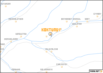
Kok-Tundy (Kyrgyzstan)Kok-Tundy is a town in Kyrgyzstan. An overview map of the region around Kok-Tundy is displayed below.
regional and 3d topo map of Kok-Tundy, Kyrgyzstan ::
Kok-Tundy airports ::
The nearest airport is OSS - Osh, located 73.9 km west of Kok-Tundy.
Nearby towns ::
Koshbulak (1.4km west) //
Salamalik (2.3km north east) //
Yalgiz-Alcha (5.6km south) //
Shamalterek (5.7km south) //
Baymam-Bet (7.0km north east) //
[all distances 'as the bird flies' and approximate] 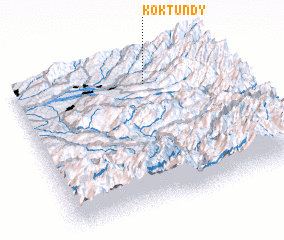
Disclaimer :: Information on this page comes without warranty of any kind |
||
|
Where is Kok-Tundy? Elevation and coordinates ::
Latitude (lat): 40°50'0"N Longitude (lon): 73°37'0"E
Elevation (approx.): 1268m (map arrows pan, magnifying glasses zoom) |
||
|
Visiting Kok-Tundy? Hotel/Accommodation ::
Book a hotel in Kok-Tundy Travel Guide ::
Buy a travel guide for Kyrgyzstan rental cars ::
car rental offers GPS waypoint ::
download a GPX waypoint (PoI) of Kok-Tundy for your GPS receiver
|
||