|
search place name
|
||
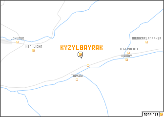
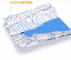
Kyzylbayrak (Kyrgyzstan)Kyzylbayrak is a town in Kyrgyzstan. An overview map of the region around Kyzylbayrak is displayed below.
regional and 3d topo map of Kyzylbayrak, Kyrgyzstan ::
Kyzylbayrak airports ::
The nearest airport is ALA - Alma-ata Almaty, located 103.8 km north east of Kyzylbayrak.
Other airports nearby include FRU - Bishkek Manas (134.3 km west), Nearby towns ::
 Places with similar names to Kyzylbayrak, Kyrgyzstan ::
// Gaiselberg (AT)
// Gasselberg (AT)
// Kasselberg (DE)
// Kesselberg (DE)
// Kesselberg (DE)
// Kieselberg (DE)
// Csillebérc (HU)
// Kızılburç (TR)
// Kızılibrik (TR)
// Kızılibrik (TR)
Disclaimer :: Information on this page comes without warranty of any kind |
||
|
Where is Kyzylbayrak? Elevation and coordinates ::
Latitude (lat): 42°45'0"N Longitude (lon): 76°4'0"E
Elevation (approx.): 1622m (map arrows pan, magnifying glasses zoom) |
||
|
Visiting Kyzylbayrak? Hotel/Accommodation ::
Book a hotel in Kyzylbayrak Travel Guide ::
Buy a travel guide for Kyrgyzstan rental cars ::
car rental offers GPS waypoint ::
download a GPX waypoint (PoI) of Kyzylbayrak for your GPS receiver
|
||