|
search place name
|
||
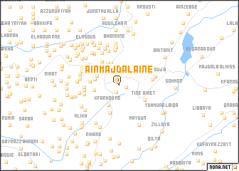
Aïn Majdalaïne (Lebanon)Aïn Majdalaïne is a town in Lebanon. An overview map of the region around Aïn Majdalaïne is displayed below.
regional and 3d topo map of Aïn Majdalaïne, Lebanon ::
Aïn Majdalaïne airports ::
The nearest airport is BEY - Beirut Rafic Hariri Intl, located 34.9 km north of Aïn Majdalaïne.
Other airports nearby include RPN - Rosh Pina Mahanaim I Ben Yaakov (60.1 km south), DAM - Damascus Intl (85.4 km east), HFA - Haifa (94.9 km south west), OMF - Mafraq King Hussein (143.0 km south east), Nearby towns ::
El Aairdâne (0.7km north west) //
Soûq aïn Qbaïa (1.0km east) //
Aadoûss (1.1km south) //
El Aaqdé (1.2km north west) //
Jezzîne (2.7km north west) //
Kfar Hoûné (3.4km south west) //
Mrâh Aazîbé (3.3km north east) //
Aazibiett Tahta (3.7km north) //
Ech Chamkha (3.7km north west) //
Hâret el Bayâder (3.3km north west) //
Ed Daïdabé (3.3km west) //
Es Souâne (3.4km west) //
Ouâdi Jezzîne (3.9km north west) //
Aïn et Tîné (4.0km south east) //
Mazraat Djâj (4.5km south) //
Ej Jdaïdé (4.4km north west) //
El Bayâda (3.9km west) //
Jouâr es Souss (4.6km north west) //
Aïn et Toghra (4.5km north west) //
Machghara (4.4km east) //
Haïtoura (4.6km west) //
El Mlekh (4.7km west) //
Er Ridm (5.6km north) //
Chouqfâne el Aarâyes (5.6km north) //
Er Roummani (4.8km west) //
El Aaouja (4.9km east) //
Bkâssîne (5.6km north west) //
Es Soueïda (6.0km north) //
Kfar Taala (6.0km north) //
[all distances 'as the bird flies' and approximate]  Places with similar names to Aïn Majdalaïne, Lebanon :: Disclaimer :: Information on this page comes without warranty of any kind |
||
|
Where is Aïn Majdalaïne? Elevation and coordinates ::
Latitude (lat): 33°31'20"N Longitude (lon): 35°36'20"E
Elevation (approx.): 1422m (map arrows pan, magnifying glasses zoom) |
||
|
Visiting Aïn Majdalaïne? Hotel/Accommodation ::
Book a hotel in Aïn Majdalaïne Travel Guide ::
Buy a travel guide for Lebanon rental cars ::
car rental offers GPS waypoint ::
download a GPX waypoint (PoI) of Aïn Majdalaïne for your GPS receiver
|
||