|
search place name
|
||
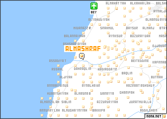
Al Mashraf (Mont-Liban, Lebanon)Al Mashraf is a town in the Mont-Liban region of Lebanon. An overview map of the region around Al Mashraf is displayed below.
regional and 3d topo map of Al Mashraf, Lebanon ::
Al Mashraf airports ::
The nearest airport is BEY - Beirut Rafic Hariri Intl, located 12.2 km north of Al Mashraf.
Other airports nearby include RPN - Rosh Pina Mahanaim I Ben Yaakov (81.7 km south), DAM - Damascus Intl (102.9 km east), HFA - Haifa (107.7 km south), OMF - Mafraq King Hussein (167.6 km south east), Nearby towns ::
Al Ḩamrāʼ (0.5km north) //
Al Lāhibīyah (1.4km south) //
Al Baţţāl (1.4km south) //
Ad Dalhamīyah (1.4km south) //
Al Qāţi‘ (1.6km west) //
Mār Mīkhāʼīl (1.6km west) //
Jall Bū Ḩaydar (1.6km west) //
Judaydah (1.6km west) //
Al Būm (2.1km south east) //
Al Khayyām (2.1km south west) //
Damour (2.3km north west) //
Ḩārat al Fawqā (2.8km north west) //
Mazra‘at an Nahr (2.8km north west) //
Ash Sharqīyah (2.8km north west) //
Mār Ilyās (2.8km north west) //
Az Zḩīt (2.8km north west) //
Ḩārat ar Ruʼūs (2.8km north west) //
Ḩārat an Nā‘imah (2.8km north west) //
Baq‘ūn at Taḩtā (3.2km south) //
Mazra‘at ar Razzānīyah (3.2km south) //
Baq‘ūn al Fawqā (3.2km south) //
Ḑahr ‘Aqlīn (3.2km south) //
Klīlay (3.1km east) //
Al Fukhaytah (3.6km south east) //
Marāḩ aţ Ţīţ (3.6km south east) //
Al Qāţi‘ (3.6km south east) //
Al Bāshiqīyah (3.6km south east) //
Ḑahr al Maghārah (3.6km south west) //
Dmīt al Jawwānīyah (3.4km south east) //
[all distances 'as the bird flies' and approximate] 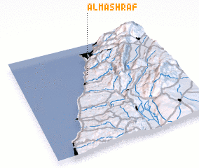 Places with similar names to Al Mashraf, Lebanon ::
// Al Mushayrifah (JO)
// Al Mushayrifah (JO)
// Al Mushayrifah (JO)
// Al Mushayrifah (JO)
// Al Mashrafah (SY)
// Al Mashrafah (SY)
// Al Mashrafah (SY)
// Al Mushayrifah (SY)
// Al Mushayrifah (SY)
// Al Mushayrifah (SY)
Disclaimer :: Information on this page comes without warranty of any kind |
||
|
Where is Al Mashraf? Elevation and coordinates ::
Latitude (lat): 33°42'45"N Longitude (lon): 35°28'1"E
Elevation (approx.): 202m (map arrows pan, magnifying glasses zoom) |
||
|
Visiting Al Mashraf? Hotel/Accommodation ::
Book a hotel in Al Mashraf Travel Guide ::
Buy a travel guide for Lebanon rental cars ::
car rental offers GPS waypoint ::
download a GPX waypoint (PoI) of Al Mashraf for your GPS receiver
|
||